
Roleystone is one of the Perth Hills’ most recognisable and tightly held lifestyle suburbs, known for its winding tree-lined roads, large lifestyle properties, orchard history and strong sense of community.
Located approximately 30 kilometres south-east of Perth within the City of Armadale, Roleystone sits within the Darling Scarp foothills surrounded by jarrah forest, valleys, granite outcrops and long-established orchard areas.
Unlike newer estates built around uniformity, Roleystone developed gradually over generations. That history still shapes the suburb today. Homes are rarely identical, blocks vary enormously in size and character, and many properties feel integrated into the natural landscape rather than built over it.
Roleystone remains primarily a detached housing suburb, with approximately 2,787 private dwellings recorded in the 2021 ABS Census, consisting overwhelmingly of standalone homes on larger blocks rather than high-density development. The suburb’s population sits at approximately 6,848 residents, sustaining a strong local community while maintaining the lower-density Hills character that defines the area.
For many buyers, Roleystone offers something increasingly difficult to find around Perth — space, individuality, nature and community, all within commuting distance of the city.
Where Roleystone Sits
Despite the semi-rural setting, Roleystone remains surprisingly accessible:
- approximately 15 minutes from Armadale
- around 25 minutes from Perth Airport
- approximately 40 minutes from the Perth CBD by car
- a short drive to Kelmscott Train Station, with services to Perth Underground in approximately 35 minutes
That balance between Hills lifestyle and city accessibility is one of the major reasons buyer demand in Roleystone remains consistently strong.
A Suburb With Deep Hills History
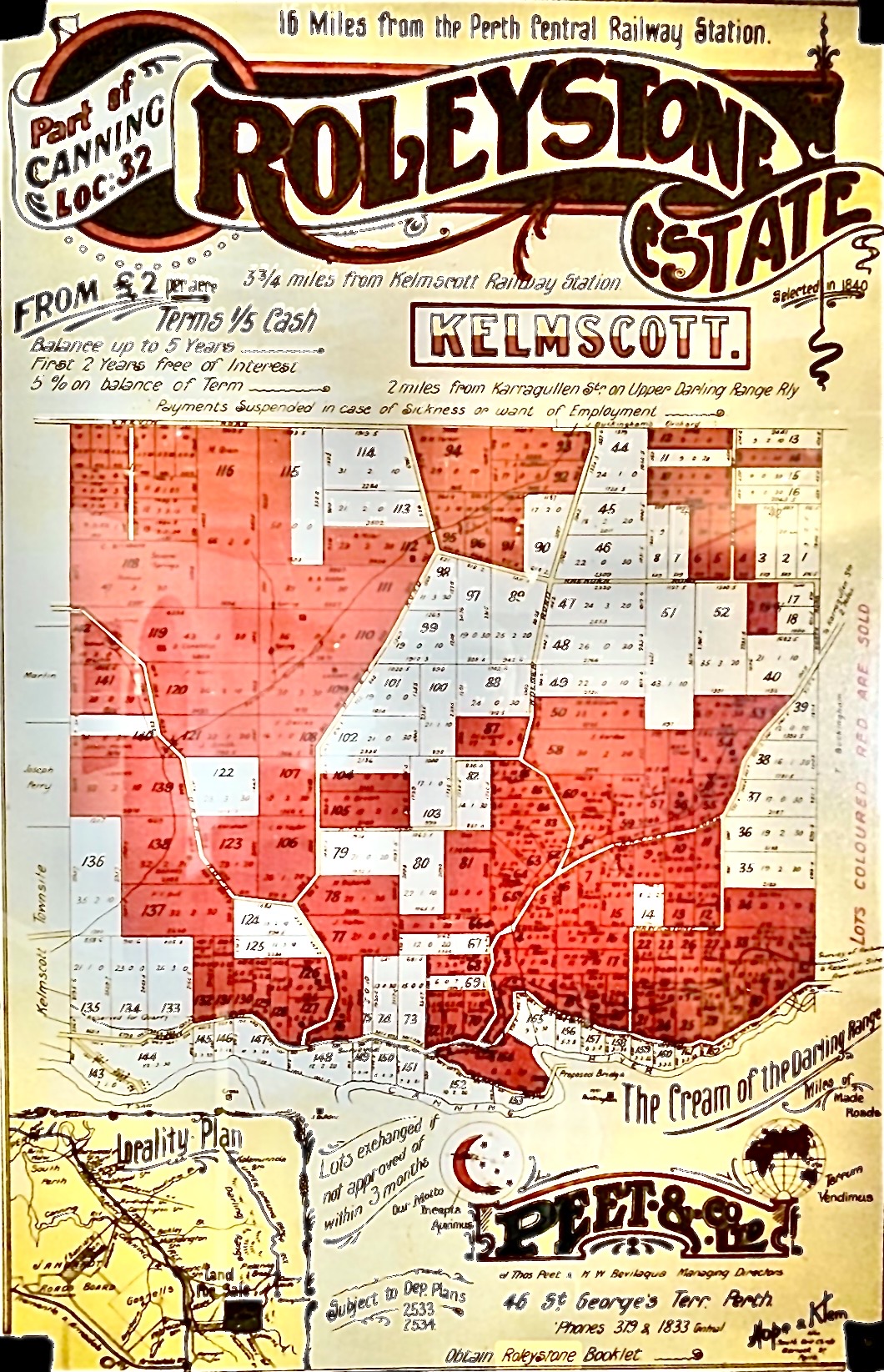
Roleystone’s history stretches back to the early colonial years of Western Australia and is deeply tied to timber milling, orcharding and early Hills settlement.
The area was first taken up by Captain Charles Churchman in 1831, who named his property “Rolleston” — the name from which the suburb is believed to derive. After Churchman’s death only a few years later, the land was eventually purchased by the Buckingham family in the late 1850s, who became central figures in the area’s development. Timber cutting and milling became major industries throughout the district during the late 1800s, helping shape the character of early Roleystone.
Over time, Roleystone developed a strong agricultural identity, particularly throughout the broader Roleystone-Karragullen corridor.
Orchards, Farming & The Area’s Italian Influence
Roleystone’s identity has been heavily shaped by its long orchard and farming history, particularly throughout the areas connecting across into neighbouring Karragullen.
For decades, the district was known for orchards producing stone fruit, citrus and other produce throughout the Hills. Terraced orchards and older fruit-growing properties became a defining part of the landscape, and many still remain today.
The area became home to a strong migrant farming community over the years, particularly Italian families who played a major role in developing and maintaining many of the orchards throughout Roleystone and Karragullen.
That agricultural history still forms an important part of the area’s identity and character. Even as many former orchard properties have gradually transitioned into lifestyle homes and larger residential holdings, the influence of the district’s farming past remains visible throughout the Hills landscape.
Long-time locals still strongly associate parts of Roleystone and Karragullen with:
- orchards and fruit trees
- terraced hillsides
- roadside produce stalls
- family-owned farming properties
- seasonal fruit picking
- agricultural traditions passed through generations
That combination of Hills lifestyle, community history and agricultural heritage is a major part of what gives Roleystone its unique identity compared to newer suburban developments around Perth.
Understanding Roleystone’s Different Areas
One of the reasons Roleystone attracts such a broad range of buyers is because the suburb contains several very different pockets and property styles.
Larger Acreage & Lifestyle Holdings
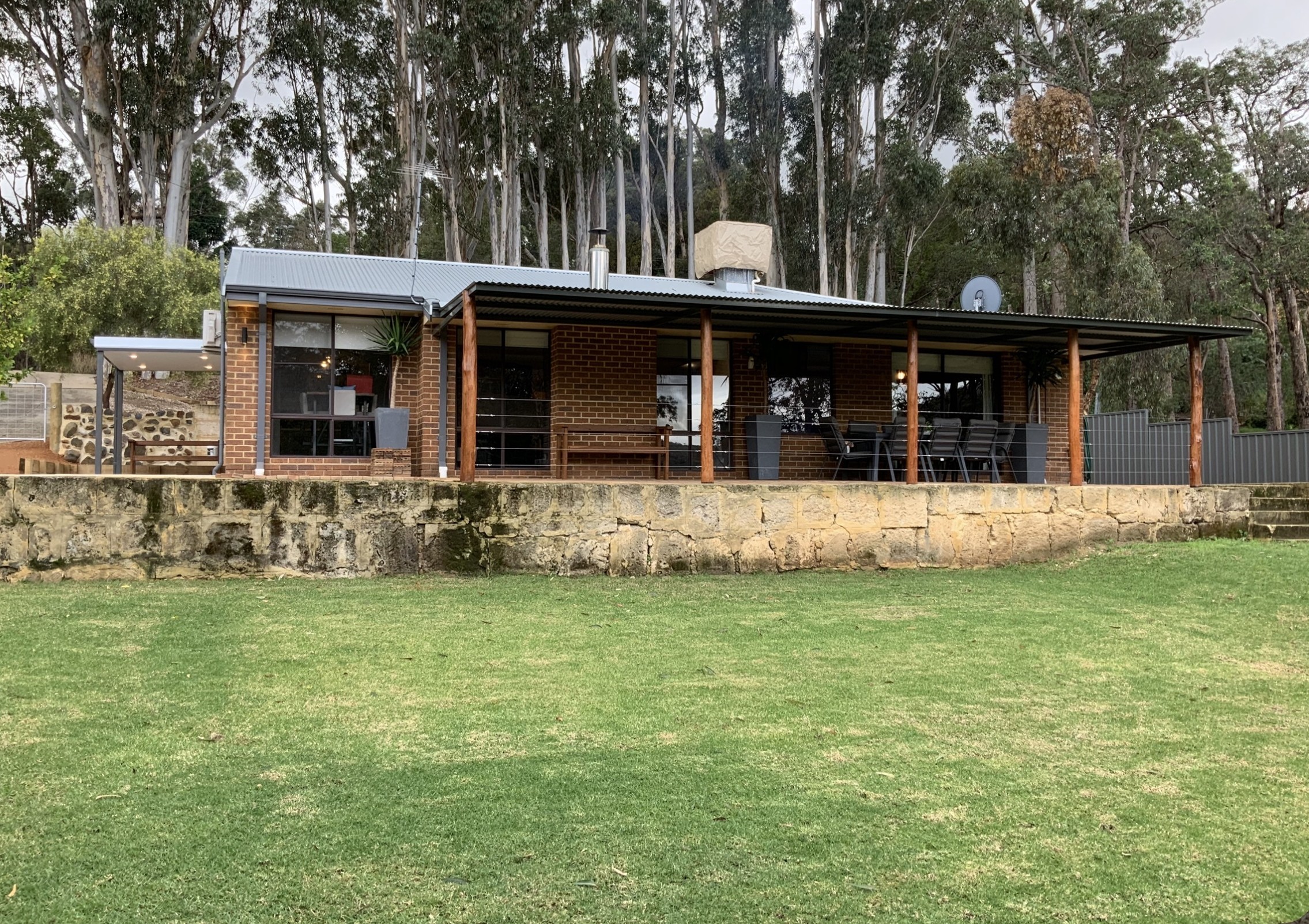
Parts of Roleystone feature larger acreage properties with workshops, horse facilities, orchards and heavily treed landscapes.
These areas are especially popular with horse owners, tradies needing space, buyers wanting privacy, families chasing a true Hills lifestyle, and buyers upgrading from suburban blocks.
Many properties throughout these areas offer valley views, natural bush settings and significant separation from neighbouring homes.
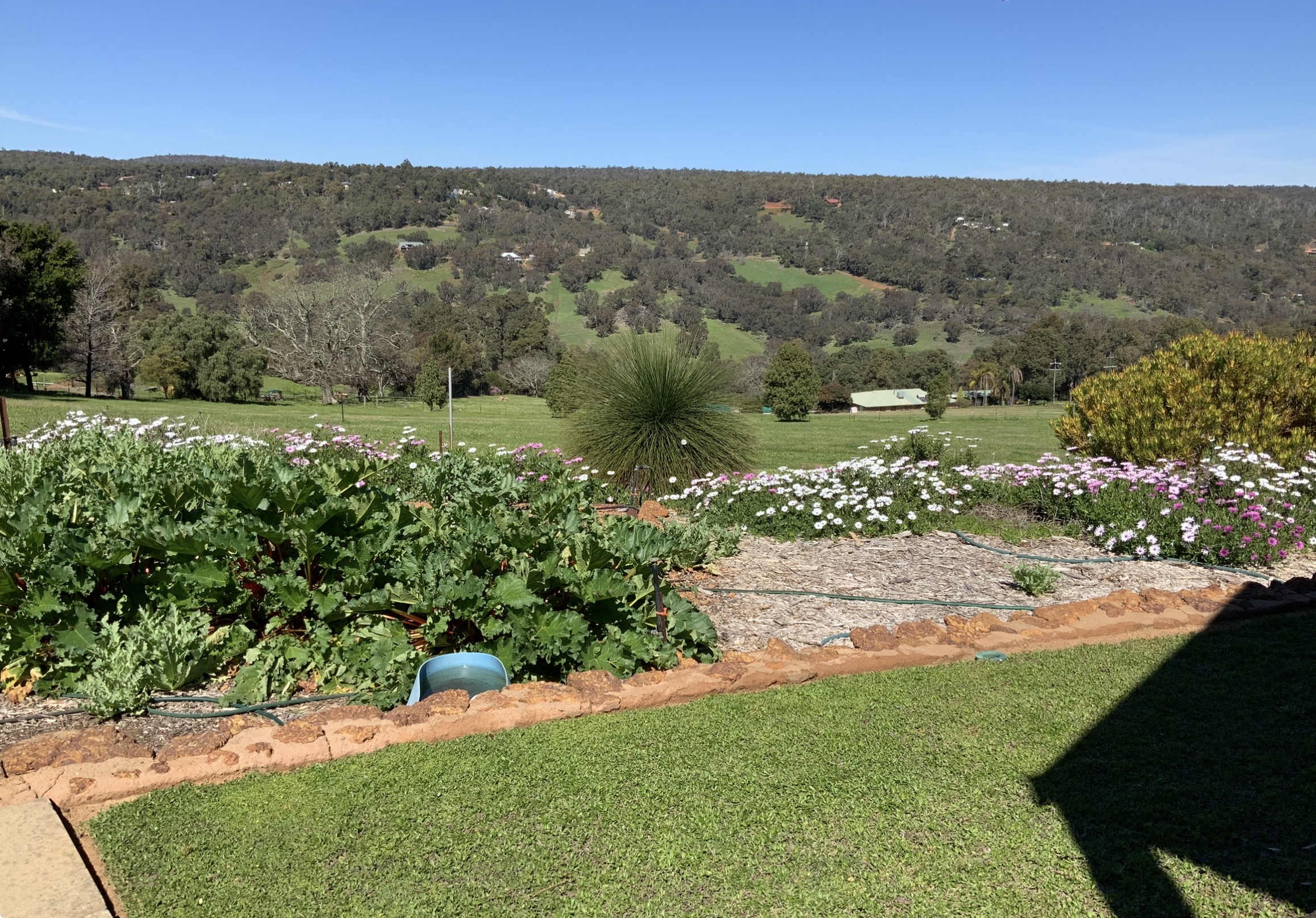
Elevated Valley View Pockets
Some parts of Roleystone are highly sought after because of their elevated positioning and sweeping views across the valleys, forest canopy and rolling Hills landscape.
These homes tend to attract buyers specifically looking for sunsets across the valleys, outdoor entertaining, architectural Hills homes, privacy, tree-lined outlooks, cooler Hills conditions and natural bushland scenery.
Well-positioned homes with valley views and strong natural outlooks often generate particularly strong buyer competition.
Village & Community-Oriented Areas
The central village area around Brookton Highway and Soldiers Road forms an important community hub within Roleystone.
This precinct includes the historic Brackenridge Village area, which sits within the recognised Roleystone Historic Precinct. The area developed from the 1920s onwards and remains an important part of the suburb’s identity today.
The precinct historically included the local co-operative store, butcher shop, post office and other small businesses that serviced the growing Hills community. Unlike many suburban shopping strips, the village area still retains a distinctly local Hills atmosphere and remains a well-known gathering point within the community.
Village Centre & Local Amenities
Unlike many Hills suburbs that rely heavily on neighbouring areas for day-to-day services, Roleystone has its own established local shopping precinct centred around Jarrah Road.
The Roleystone Shopping Centre and surrounding village area provide a range of everyday conveniences including:
- grocery shopping
- cafés and takeaway options
- pharmacy services
- medical and professional services
- local specialty businesses
For many residents, that local village atmosphere is part of the suburb’s appeal. The shopping precinct still feels community-focused rather than heavily commercialised, reinforcing the small-town Hills character Roleystone is known for.
The suburb also remains within easy reach of larger commercial centres including Kelmscott, Stargate Shopping Centre and Armadale Central.
Araluen Botanic Park & The Tulip Festival
One of Roleystone’s best-known attractions — and one of Perth’s most iconic spring destinations — is Araluen Botanic Park.
Located within the Brookton Valley area of Roleystone, Araluen Botanic Park has been operating since 1930 and has become internationally recognised for its annual Springtime Tulip Festival, which attracts thousands of visitors to the Perth Hills every spring.
The gardens themselves combine landscaped gardens, waterfalls, streams, bushland and walking trails throughout a sheltered valley setting.
During spring, the annual Tulip Festival transforms the park into one of Western Australia’s most photographed seasonal attractions, with more than 250,000 tulips and tens of thousands of additional spring bulbs blooming throughout the gardens.
For locals, Araluen is more than just a tourist attraction. It forms part of the suburb’s identity and lifestyle, with residents enjoying picnics, walking trails, weddings and events, seasonal festivals, concerts and outdoor performances, and gardens and natural scenery year-round.
The park also contributes significantly to Roleystone’s reputation as one of Perth’s most scenic Hills suburbs.
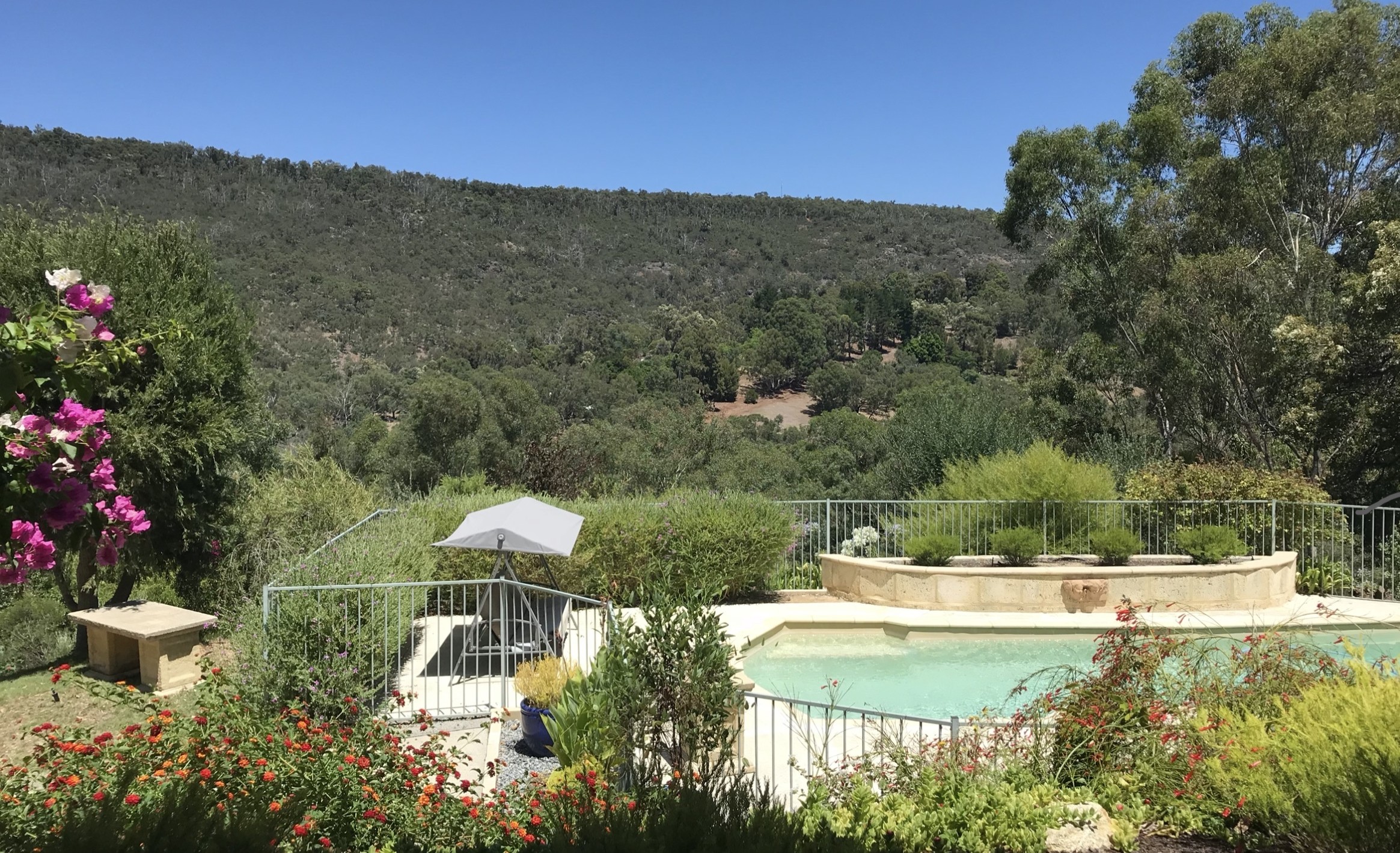
Araluen Estate, Golf Course & Resort Lifestyle
One of Roleystone’s most recognisable lifestyle destinations is Araluen Estate, located within the Brookton Valley area of the suburb.
Originally developed during the 1990s, Araluen Estate combines one of Western Australia’s best-known golf courses with a luxury residential estate, clubhouse, restaurant and function venue surrounded by native bushland and dramatic valley scenery.
The championship golf course opened in 1994 and was designed by renowned golf course architect Michael Coate together with Australian touring professional Roger Mackay. Built throughout steep natural terrain surrounded by forest and the Canning River valley system, the course quickly developed a reputation as one of the most visually striking golf courses in Western Australia.
Today, Araluen Estate remains highly regarded not only for golf, but also for weddings and events, restaurant and clubhouse facilities, luxury Hills living, premium homes integrated throughout the estate, and natural scenery and valley views.
The residential estate itself operates under specific design guidelines intended to maintain a low-density, high-quality Hills environment integrated with the surrounding landscape.
For buyers, the Araluen precinct offers a very different style of living compared to other parts of Roleystone, combining executive-style homes, golf course frontage, bushland surroundings, a resort-style atmosphere and premium Hills living.
The estate also sits adjacent to the historic Araluen Botanic Park, helping form one of the most recognisable lifestyle precincts within the Perth Hills.
What Buyers Love About Roleystone
Roleystone attracts buyers looking for lifestyle first.
People move here because they want space, privacy, trees, wildlife, character homes, workshops and sheds, larger blocks, orchards and gardens, a quieter pace of life, and a stronger community connection.
The suburb is particularly popular with buyers wanting to escape dense suburban estates, small blocks, traffic congestion and cookie-cutter developments.
One of the biggest attractions is that many Roleystone properties feel genuinely unique. Buyers are often choosing between architect-designed Hills homes, renovated character properties, bushland retreats, lifestyle acreages, horse properties, orchard properties and modern family homes with valley views.
That individuality is a major part of the suburb’s appeal.
Nature, Trails & Outdoor Lifestyle
Roleystone is heavily connected to the surrounding natural landscape and outdoor lifestyle.
The suburb is surrounded by bushland, walking trails and national park areas, giving residents direct access to some of the Hills’ best natural scenery.
One of the best-known local attractions is Roley Pools, located along the Canning River. The area was a popular swimming and picnic destination from the early 1900s and remains one of the suburb’s most recognised natural landmarks today.
Residents also enjoy hiking trails, mountain biking, horse riding, birdlife and native wildlife, waterfalls and granite outcrops, and bushwalking throughout the Hills.
For many locals, the natural environment is one of the biggest reasons they stay in Roleystone long-term.
Community & Village Atmosphere
Roleystone has one of the strongest community identities in the Perth Hills.
Unlike many newer suburbs, there is a long-standing sense of local involvement and connection throughout the area.
The suburb is known for volunteer community groups, strong local sporting clubs, local arts and creative communities, school involvement, Hills events and markets, local fire brigades and long-established family networks.
The village precinct around Brookton Highway and Soldiers Road remains an important meeting place for the community and contributes heavily to the suburb’s identity.
For many buyers, that sense of belonging becomes just as important as the property itself.
Schools & Family Appeal
Roleystone is particularly popular with families wanting a Hills upbringing for their children while still remaining connected to Perth.
The suburb offers access to Roleystone Community College — a Kindergarten to Year 10 Independent Public School set in jarrah bushland, known locally for its specialist Film and Television program. Secondary students continuing through Years 11 and 12 typically transition to nearby high schools.
Other educational and community resources include:
- local primary schools
- Southern Hills Christian College nearby
- sporting clubs and recreation facilities
- music and arts programs
- large outdoor spaces and parks
Many families are specifically attracted to the combination of larger blocks, quieter streets, outdoor lifestyle, stronger community feel and reduced suburban density.
Important Things Buyers Should Understand
Roleystone is not a standard suburban market, and buyers need to understand the practical side of Hills living.
Depending on the property, buyers may need to consider:
- bushfire preparedness
- BAL (Bushfire Attack Level) ratings
- septic systems
- water tanks and bore water
- steep driveways
- slope and drainage
- retaining requirements
- tree maintenance
- wildlife
- internet and mobile coverage in some pockets
For serious Hills buyers, these are generally considered part of the lifestyle rather than drawbacks. However, local knowledge becomes extremely important because conditions can vary dramatically from one street to another.
Roleystone Market Snapshot
Roleystone remains one of the Perth Hills’ strongest-performing lifestyle markets.
Recent figures show:
- approximately 30 homes sold in the previous six months
- around 4 homes available for sale
- average days on market sitting at 12 days
- median sale price reaching approximately $1,250,000
- median values increasing 32% over 12 months
Recent sales throughout Roleystone have ranged from smaller lifestyle homes through to premium acreage properties.
Well-positioned homes with valley views, usable land, workshops or strong lifestyle appeal continue to attract significant buyer competition.
For the most current market data, see our latest Roleystone Market Update Report. [Link to market update reports page once live.]
Selling in Roleystone
Selling a property in Roleystone requires a very different strategy compared to selling a standard suburban home.
Buyers are not simply comparing bedroom counts and floorplans. They are comparing:
- views
- privacy
- land usability
- tree coverage
- water setup
- workshops and sheds
- entertaining areas
- bushland setting
- driveway access
- orchard potential
- architectural character
- overall lifestyle appeal
The emotional side of the property matters heavily in Roleystone, which means presentation, photography and storytelling become especially important.
Why Work With Naked Real Estate
Experience matters in any market. The wrong choice of agent can cost you thousands — so why risk your biggest asset?
Brendan Leahy has been selling property throughout the Perth Hills since 2002. He founded his own agency in 2006 and rebranded to Naked Real Estate in 2012, with a continued focus on Roleystone, Bedfordale, Mount Nasura, Mount Richon, Kelmscott and Seville Grove.
With over 1,503 personal home sales and more than $760 million in total sales value across his career, Brendan brings genuine local experience to a market where property differences can vary enormously from one street to the next.
In a suburb built around character, history and lifestyle, local knowledge matters. Understanding the different pockets, buyer types, view corridors, orchard areas, land usability and lifestyle appeal can make a significant difference when it comes to pricing and marketing strategy.
In Roleystone, no two properties are ever truly the same — and that’s exactly the kind of market where experience and local understanding pay off.
