Daily Archives: November 17, 2020

Gosnells

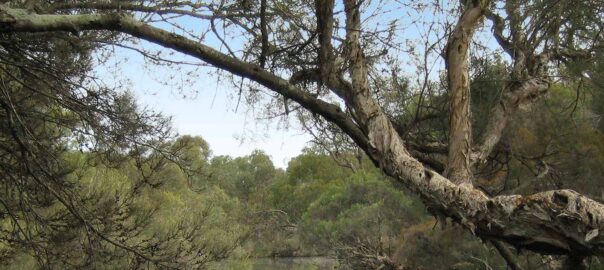
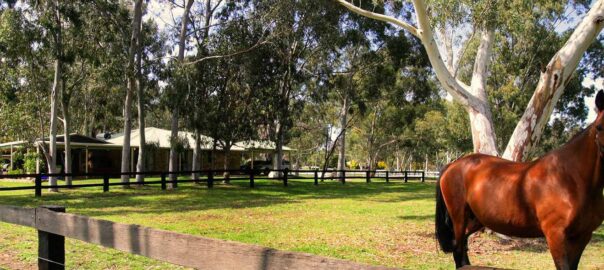
Established in 1890, Gosnells is a thriving southeastern suburb in Perth that spans 15 square kilometres and is home to more than 19,000 residents. Bound by Canning River to the north and east and Wungong Brook and the Southern River to the south, Gosnells enjoys proximity to these natural wonders while simultaneously benefiting from facilities and attractions synonymous with a bustling urban environment.

Life in Gosnells

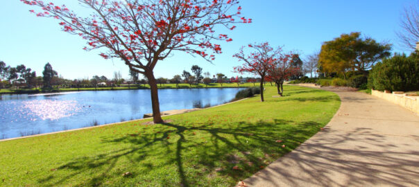
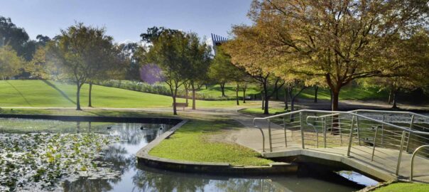
There is no shortage of things to do in Gosnells. For those who crave the outdoors and nature there are upwards of 30 parks, reserves and wetlands within the area for you to explore, as well as fitness and athletic facilities like the Harmony Fields Fitness Track, which offers all the benefits of a gym without the costly membership fees. Other major features of the area include the Gosnells Railway Station, Gosnells Railway Markets, Foothills Shopping Centre, Gosnells Shopping Centre, City of Gosnells Museum and numerous schools like Gosnells Primary School and St Munchin’s Catholic School. There are also tennis courts, skate parks, a leisure centre and the Addie Mills Centre, which provides programs and services to seniors and people with disabilities.

Gosnells Facts

Distance to Perth(km): 20
Postcode: 6110
Local Government: Gosnells
Local Schools: Gosnells P.S., Ashburton Drive P.S., St Munchins P.S., Gosnells S.H.S., Seaforth P.S., Wirrabirra P.S
Nearby Schools: Sacred Heart Primary School (Thornlie) , Good Shaperd Catholic Primary School (Kelmscott) , John Wollaston Anglican Community School (Kelmscott)
Nearby Shops: Corfield and Ashburton Village, Thornlie Square
Train Stations: Seaforth or Gosnells
Bus Services: Bus Service to Seaforth or Gosnells train stations

(Source:REIWA)

Ferndale

Life in Ferndale

Located 10km from the Perth CBD, Ferndale is still one of the most affordable areas close to the city and is surrounded by neighbouring suburbs that provide major shopping centres, schools, parks and great cafes and restaurants.

Notable features include Ferndale Reserve, a large sports ground, and located in Ferndale’s North, The Canning River Regional Park. The park is a tranquil natural oasis, with beautiful wetlands full of birdlife, and landscaped gardens. It is also a popular route for cycling and walking.

Ferndale Facts

Distance to Perth(km) : 10
Postcode : 6148
Local Government : Canning
Local Schools : Kinlock Primary School, Bannister Creek Primary School, Ferndale Primary School
Nearby Schools : St Emilie’s Catholic Primary School (Canning Vale) , St Jude’s Catholic School (Langford) , Sacred Heart Primary School (Thornlie)
Nearby Shops : Riverton Forum, Westfield Carousel
Train Stations : Cannington
Bus Services : Bus service to Cannington Train Station
(Source : REIWA )

East Cannington

East Cannington is an established suburb southeast of Perth. Home to approximately 4,300 people, East Cannington’s most substantial development period occurred during the 1960s and 1970s. More recently, East Cannington has ranked as a top growth suburb within the Perth metropolitan area following significant expansion between 2006 and 2011.

Life in East Cannington

Parks and reserves characterise the sections of the East Cannington landscape not used for housing purposes with minimal commercial activity in the area. While predominantly the suburb relies on facilities in surrounding neighbourhoods, there is a small shopping centre within the East Cannington precinct that takes care of immediate grocery and amenity requirements.

East Cannington Facts

Distance to Perth (km): 14
Postcode: 6107
Local Government: Canning
Local Schools: Gibbs Street Primary School
Nearby Schools: St Joseph’s School (Queens Park) , St Norbert College (Queens Park)
Nearby Shops: East Cannington Square, Westfield Carousel
Train Stations: Beckenham or Cannington
Bus Services: Bus service to Beckenham Train Station

(Source: REIWA)

Darling Downs

Darling Downs is an outer southeastern suburb of Perth, Western Australia, within the Shire of Serpentine-Jarrahdale. The name, referring to the suburb’s proximity to the Darling Scarp, was first used as an estate name in 1977, and adopted as a suburb name in 1997. If you are looking for nature but not ready to leave the city, Darling Downs could be for you.

Darling Downs Facts

Distance to Perth(km): 31
Postcode: 6122
Local Government: Serpentine-Jarrahdale
Nearby Schools: Xavier Catholic School (Brookdale) , Helena College Junior School (Darlington)
Train Stations: Armadale
Bus Services: Bus Service to Armadale Train Station

(Source: REIWA)

Cannington

With settlement dating from the 1840s, Cannington didn’t experience significant residential development until the post-war years. Rapid growth began in the 1960s with another substantial increase occurring in the 1990s. Part of the City of Canning, Cannington has substantial commercial sectors within its four square kilometre land area.

Life in Cannington

Cannington is well serviced by a mixture of retail and recreational facilities. Westfield Carousel Shopping Centre is a major fixture of Cannington with everything from extensive retail shops, a gym, pub, restaurants and cinema available here. There are numerous parks for locals to enjoy as well as the Canning River, which bounds the suburb to the south. Local schools include Cannington Primary School and Cannington Community College.

Cannington Facts

Distance to Perth (km): 10
Postcode: 6107
Local Government: Canning
Local Schools: Cannington P.S., Saint Joseph’s P.S., Saint Norbert College, Cannington Community College, Cannington Education Support Centre, Kids of the Park Community Kindergarten, Sowilo Community High School , Damla College
Nearby Schools: St Jude’s Catholic School (Langford)
Nearby Shops: Westfield Carousel
Train Stations: Cannington
Bus Services: Local bus service

(Source: REIWA)

Canning Vale

Canning Vale is named for its location which is a low lying area near the Canning River, which was named after George Canning, former Prime Minister of Great Britain. Population was minimal until the late 1980s, following industrial development in the 1970s. This industrial development has now grown and banister rd is now a complete industrial and commercial site.
The industrial growth, did not deter the residential growth from thriving. In the early 1990’s the population underwent massive growth and grew to over 9000 in 2006. Even today there are more estates still being built and expanded into the neighboring Southern River areas. In 2011 the population reached 30,000, which was has been largely due to the reasonable affordability mix of each dwelling type- leased, owner occupied and mortgaged.

Life in Canning Vale

Canning Vale is just 14km away from the city centre and has several schools to choose from. Local facilities include Canning Vale Shopping Centre, Market City, The Vale Shopping Centre, Whaleback Golf Club, Canning Vale Country Club, Canning Vale Cricket Club and Perth Tamil Cricket Club. There are also lots of walking trails down by the Canning River and throughout the wetlands of Canning Vale. There are some lovely residential areas that are modern with well-manicured gardens, making this suburb a popular place to live.

Canning Vale Facts

Distance to Perth(km): 17
Postcode: 6155
Local Government: Canning/Gosnells
Local Schools: Caladenia P.S., Canning Vale P.S., Campbell P.S., Canning Vale Catholic P.S., Canning Vale Ed Support Centre, Ranford P.S., Canning Vale College, Carey Baptist College, Excelsior P.S., Saint Emilie’s Catholic Primary School
Nearby Schools: St Jude’s Catholic School (Langford) , Sacred Heart Primary
Nearby Shops: Livingston Market Place Shopping Centre, Waratah Village
Train Stations: Murdoch
Bus Services: Local bus service, Bus to Murdoch Train Station

(Source:REIWA)