Named after the river that runs through the area, Southern River is part of the City of Gosnells locality. Spanning 14 square kilometres, Southern River provides a family-friendly lifestyle. Extensive urban development in the early 2000s saw the suburb subdivided and urbanised into the functional area it is today, with care taken to preserve much of the wetlands for public recreation.
Life in Southern River
Bound by Southern River Road and Wungong Brook in the north, Tonkin Highway in the east, Ranford Road in the south and Warton Road in the west, Southern River has plenty to offer its residents. One of the highlights of the suburb is Sutherlands Park, a large sporting complex that provides a focus for cricket and football for Southern River, Thornlie and Gosnells. Other notable parks and reserves include Castlewood Parkway and Sanctuary Waters, both of which are built around a lake. Local schools in the area include Bletchley Park Primary School, Southern River College and Thornlie Christian College.
Southern River Facts
Distance to Perth(km): 18
Postcode: 6110
Local Government: Gosnells
Local Schools: Bletchley Park P.S., Southern River P.S., Thornlie Christian College
Nearby Schools: St Munchin’s Catholic School (Gosnells) , Sacred Heart Primary School (Thornlie)
Nearby Shops: Southern River Shopping Centre
Train Stations: Southern River
Bus Services: Bus to Murdoch Train Station
Seville Grove is one of the most practical family suburbs in the Armadale/Kelmscott corridor, offering established homes, newer cottage-block housing, shopping, schools, parks, recreation and strong transport access.
It borders the western boundary of Kelmscott and is generally framed by Braemore Street, Champion Drive and Lake Road.
Seville Grove is a substantial residential suburb, but it should not be treated as one single market. It has different pockets, different housing styles and different buyer appeal depending on where the property sits.
For sellers, that matters.
A home in the original Kadima Park area should not be positioned exactly the same way as a newer cottage-block home on the north-eastern side of Poad Street and Seville Drive.
Where Seville Grove Sits
Seville Grove sits directly west of Kelmscott and close to Armadale, making it a practical suburb for buyers who want access to shops, schools, transport and everyday services without moving too far from major local centres.
Key location points:
Western boundary of Kelmscott Close to Armadale Access to Kelmscott train station Access to Armadale train station Sherwood Station access for parts of western Seville Grove Champion Drive Lake Road Braemore Street Seville Grove Shopping Centre Armadale Aquatic Centre Local schools Local parks and reserves
The suburb’s strength is convenience. It is well positioned for families, first-home buyers, investors and downsizers who want a practical residential location close to established amenities.
[IMAGE: Strong Seville Grove streetscape, shopping centre, or aquatic centre]
Caption: Seville Grove offers practical family living close to Kelmscott, Armadale, shops, schools, transport and local recreation.
Understanding Seville Grove’s Different Pockets
Seville Grove has grown in stages, and those stages still affect how homes should be valued and marketed today.
The suburb was originally made up of orchards and horse properties, with riding schools operating in the area. Over time, it developed into residential estates with a mix of older 3- bedroom and 4-bedroom homes, family-sized blocks and newer cottage-block housing.
The suburb is best understood in four key pockets:
1. Kadima Park — the original estate
2. Strawberry Park — established homes on family blocks
3. The newer north-eastern section — cottage blocks around Poad Street and Seville Drive
4. Established family streets throughout the original sections
Each area has a different feel and a different buyer profile.
Kadima Park — The Original Estate
Kadima Park was the original estate that started Seville Grove.
It sits on the south-eastern side of the suburb near the Armadale Aquatic Centre and is broadly defined by the streets around:
Brown Crescent Morgan Road Ralphs Street Surrounding streets close to the aquatic centre
This pocket gives Seville Grove much of its established residential identity.
Homes here generally sit on larger blocks — often around 500m2 to 800m2 — and are commonly 3-bedroom, 1-bathroom or 4-bedroom, 2-bathroom homes.
Key features: Original Seville Grove estate area Near Armadale Aquatic Centre Established homes Larger original block sizes Common 3×1 and 4×2 home styles Family buyer appeal Practical access to parks, schools and local facilities
This area should usually be marketed around space, established family living, block size and convenience.
[IMAGE: Kadima Park / aquatic centre / established street] Caption: Kadima Park is one of Seville Grove’s original residential pockets, with established family homes and practical access to local amenities.
Strawberry Park
Strawberry Park came after Kadima Park and is another important part of Seville Grove’s development story.
This area is generally around the western end of Seville Drive, Poad Street and the side closer toward Armadale.
Like the original areas, Strawberry Park tends to include established homes on practical family-sized blocks. These homes often appeal to buyers looking for space, value, access and a traditional suburban layout.
Key features: Established residential pocket Around western Seville Drive and Poad Street Practical access to Armadale Family-sized blocks Established homes Strong buyer appeal for families and investors
Strawberry Park gives buyers a more established Seville Grove option compared with some of the newer, smaller-block sections.
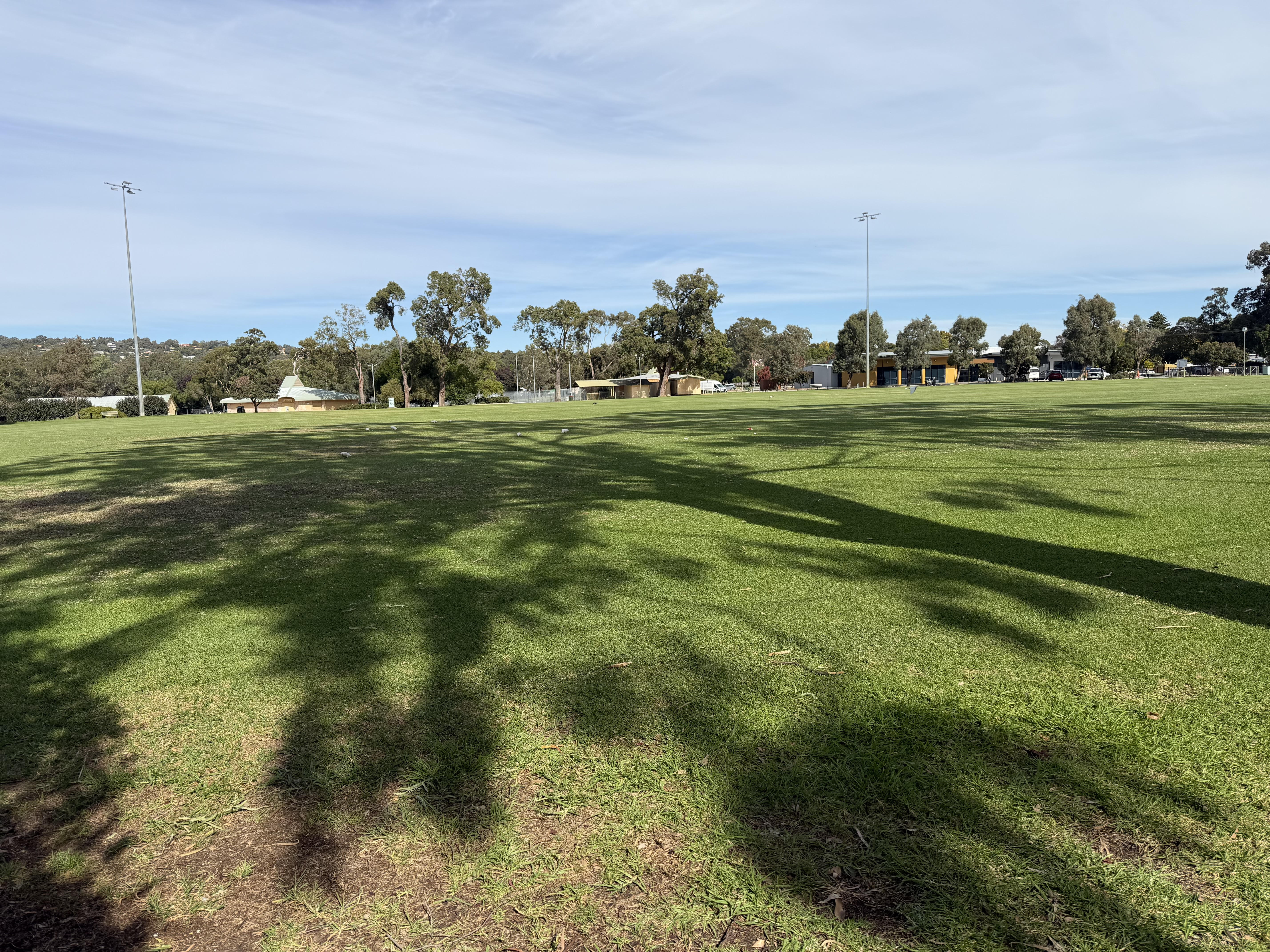
[IMAGE: Strawberry Park local park, street, or family-housing image] Caption: Strawberry Park offers established Seville Grove living with practical block sizes and strong family appeal.
Newer North-Eastern Section
On the north-eastern side of Poad Street and Seville Drive, Seville Grove becomes newer in feel.
This area generally has smaller cottage-style blocks, often around 300m2 to 500m2, and appeals strongly to young families, first-home buyers and buyers wanting a lower-maintenance property.
Key features: Newer housing area Smaller cottage blocks Typical block sizes around 300m2 to 500m2 Popular with young families Lower-maintenance appeal Access to schools and parklands Practical modern housing stock
This area is not weaker than the older sections — it is just different. It attracts a different buyer group. Some buyers want a larger older block. Others want a newer, easier-care home close to schools and parks. The selling strategy should reflect that.
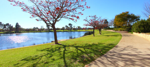
[IMAGE: Newer street / parkland / family-focused image] Caption: The newer sections of Seville Grove offer smaller cottage blocks, modern family homes and easy-care living close to parks and schools.
Seville Grove’s Orchard And Horse Property History
Before Seville Grove became a major residential suburb, the area was known for orchards and horse properties. Riding schools also operated in the area, giving the suburb a semi-rural past that many newer buyers may not realise.
This history helps explain why parts of Seville Grove still feel different from newer, fully planned suburbs. Some streets carry a more established feel, while newer areas have a tighter modern residential layout.
[IMAGE: Local character image, parkland, or open-space photo] Caption: Before its residential growth, Seville Grove had strong links to orchards, horse properties and local riding schools.
Who Buys In Seville Grove
Seville Grove attracts a broad mix of buyers because it offers affordability, location and family practicality.
Common buyer groups include: Young families First-home buyers Investors Downsizers Buyers wanting good transport access Buyers wanting access to Armadale and Kelmscott Families wanting schools and parklands nearby Buyers wanting 3×1 or 4×2 homes on practical blocks Buyers looking for lower-maintenance cottage-block homes Buyers priced out of Kelmscott or surrounding suburbs
This is a suburb where the buyer profile changes depending on the pocket. A larger original-block home in Kadima Park will not always attract the same buyer as a newer cottage-block home near Poad Street.
Schools, Parks And Family Appeal
Seville Grove is popular with families because it has access to local schools, parks, shopping and recreation.
Key family appeal: Access to local schools Parklands and recreation areas Seville Grove Shopping Centre Armadale Aquatic Centre Public transport to Armadale and Kelmscott train stations Sherwood Station access for parts of western Seville Grove Practical family homes A mix of larger and smaller blocks Established community feel
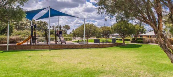
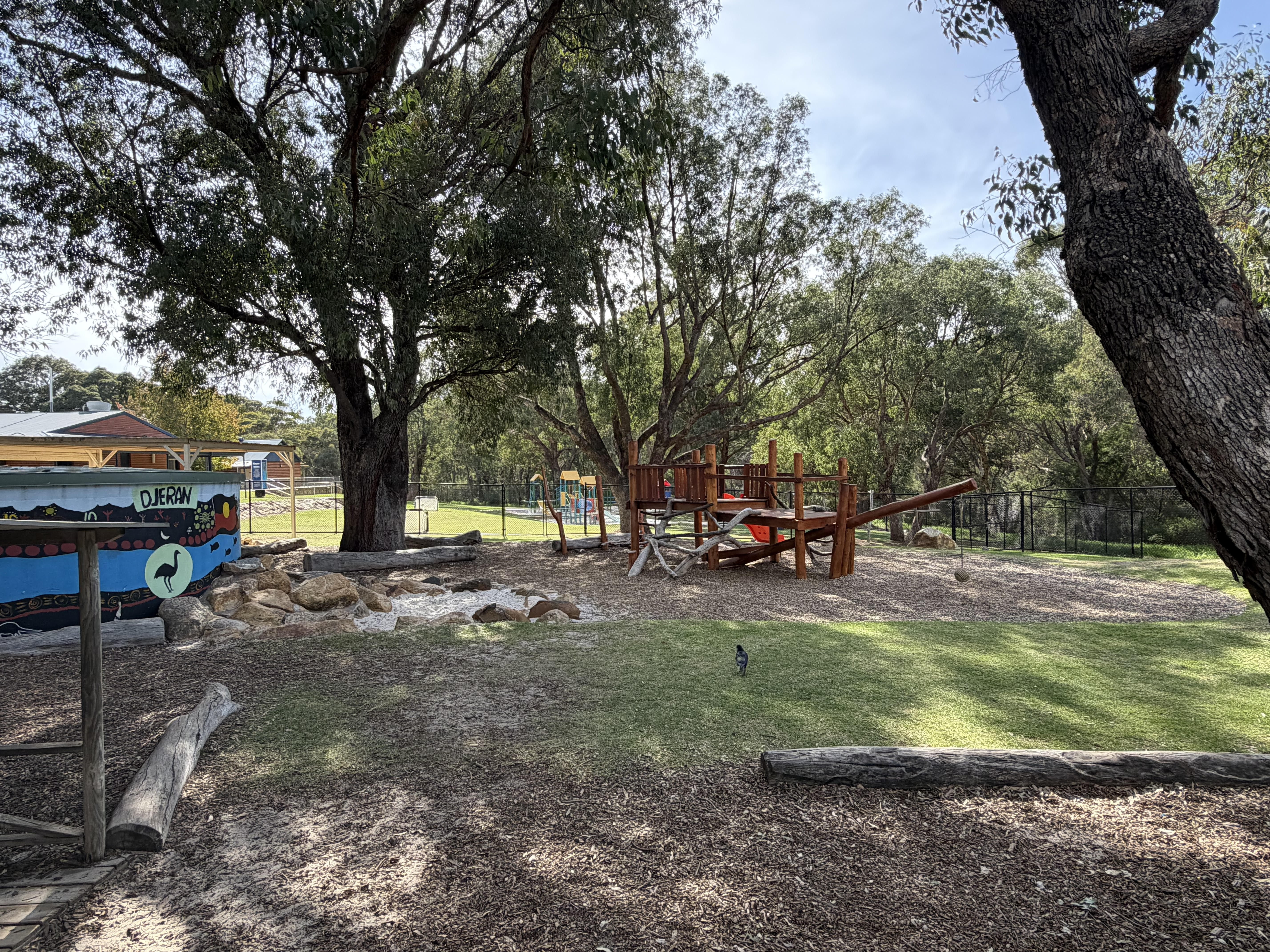
[IMAGE: School, playground, park or aquatic centre] Caption: Seville Grove is popular with families thanks to its schools, parklands, shopping, transport access and recreational facilities.
Shopping, Transport And Local Convenience
Seville Grove has strong everyday convenience. The suburb has a good local shopping centre and is home to the Armadale Aquatic Centre, which adds a strong lifestyle and recreation feature for local residents. Public transport is also a major advantage.
The main train stations serving Seville Grove are Armadale Station and Kelmscott Station, with bus connections through the area. For residents on the western side of Seville Grove, Sherwood Station can also be within walking distance, depending on the exact property location.
Key convenience points: Seville Grove Shopping Centre Armadale Aquatic Centre Bus connections to Armadale train station Bus connections to Kelmscott train station Sherwood Station access for parts of western Seville Grove Champion Drive access Lake Road access Close to Armadale town centre Close to Kelmscott
This makes Seville Grove a practical suburb for buyers wanting everyday services close by without paying surrounding-suburb prices.
[IMAGE: Shopping centre, aquatic centre, or transport image] Caption: Seville Grove offers strong everyday convenience, with local shopping, recreation and public transport links to Armadale, Kelmscott and Sherwood stations.
Important Things Buyers Should Understand
Seville Grove should not be judged by one suburb average.
Buyers should understand: Kadima Park is the original estate Strawberry Park has its own established identity Newer areas have smaller cottage blocks Original areas often have 500m2 to 800m2 blocks Newer areas are often 300m2 to 500m2 Home styles vary between 3×1, 4×2 and newer family homes Access to transport differs by pocket Some areas are closer to Armadale Some areas are closer to Kelmscott Western Seville Grove may have better walking access to Sherwood Station Parkland and school access can influence buyer demand Presentation matters strongly in family suburbs
A larger original-block home should be marketed differently from a newer cottage-block property. Both can perform well, but they appeal to different buyers.
Selling In Seville Grove
Selling in Seville Grove requires understanding the pocket, block size and buyer type.
The right selling strategy depends on what the home offers:
Kadima Park homes should often be marketed around established family living, original estate appeal, block size and access to recreation
Strawberry Park homes should be positioned around established homes, practical family blocks and access
Newer north-eastern homes should focus on easy-care living, young families, parklands and modern convenience
Homes close to shopping, schools or transport should make that convenience clear
Homes in western Seville Grove may benefit from highlighting Sherwood Station access where genuinely walkable
This is not a suburb where sellers should rely on generic marketing. The right campaign needs to show why that particular property fits the buyer demand in that part of Seville Grove.
In 2025, Naked Real Estate’s Seville Grove sales averaged +13.13% above list price — built on the kind of local pocket knowledge that turns generic marketing into sharp positioning.
Why Work With Naked Real Estate In Seville Grove
Seville Grove is a suburb where local knowledge makes a difference.
The original estates, newer sections, block sizes, family buyer groups, transport access, schools, parks and shopping all affect how a property should be positioned.
Brendan Leahy and the Naked Real Estate team understand the local market across Seville Grove, Kelmscott and the surrounding suburbs. With 1,503+ personal sales, deep local experience and the trademarked Select Date Sale® strategy, Naked Real Estate helps Seville Grove sellers position their property clearly, attract the right buyers and create competition.
Truth. Strategy. Sold.
Thinking of selling in Seville Grove?
Speak with Brendan Leahy at Naked Real Estate for direct, practical advice on where your property sits in today’s market.
Book a Seville Grove appraisal or call 08 6254 6333
Roleystone is one of the Perth Hills’ most recognisable and tightly held lifestyle suburbs, known for its winding tree-lined roads, large lifestyle properties, orchard history and strong sense of community.
Located approximately 30 kilometres south-east of Perth within the City of Armadale, Roleystone sits within the Darling Scarp foothills surrounded by jarrah forest, valleys, granite outcrops and long-established orchard areas.
Unlike newer estates built around uniformity, Roleystone developed gradually over generations. That history still shapes the suburb today. Homes are rarely identical, blocks vary enormously in size and character, and many properties feel integrated into the natural landscape rather than built over it.
Roleystone remains primarily a detached housing suburb, with approximately 2,787 private dwellings recorded in the 2021 ABS Census, consisting overwhelmingly of standalone homes on larger blocks rather than high-density development. The suburb’s population sits at approximately 6,848 residents, sustaining a strong local community while maintaining the lower-density Hills character that defines the area.
For many buyers, Roleystone offers something increasingly difficult to find around Perth — space, individuality, nature and community, all within commuting distance of the city.
Where Roleystone Sits
Despite the semi-rural setting, Roleystone remains surprisingly accessible:
approximately 15 minutes from Armadale
around 25 minutes from Perth Airport
approximately 40 minutes from the Perth CBD by car
a short drive to Kelmscott Train Station, with services to Perth Underground in approximately 35 minutes
That balance between Hills lifestyle and city accessibility is one of the major reasons buyer demand in Roleystone remains consistently strong.
A Suburb With Deep Hills History
Roleystone’s history stretches back to the early colonial years of Western Australia and is deeply tied to timber milling, orcharding and early Hills settlement.
The area was first taken up by Captain Charles Churchman in 1831, who named his property “Rolleston” — the name from which the suburb is believed to derive. After Churchman’s death only a few years later, the land was eventually purchased by the Buckingham family in the late 1850s, who became central figures in the area’s development. Timber cutting and milling became major industries throughout the district during the late 1800s, helping shape the character of early Roleystone.
Over time, Roleystone developed a strong agricultural identity, particularly throughout the broader Roleystone-Karragullen corridor.
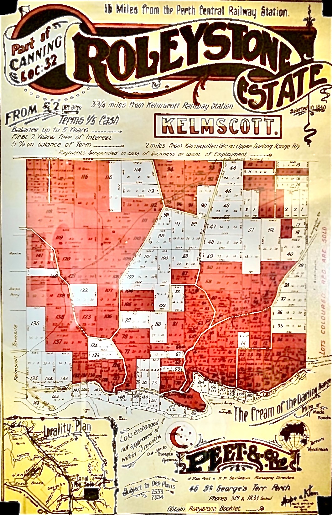
The Cream of the Darling Range — an original Peet & Co land sale poster for Roleystone Estate, with Buckingham’s Orchard marked on the map
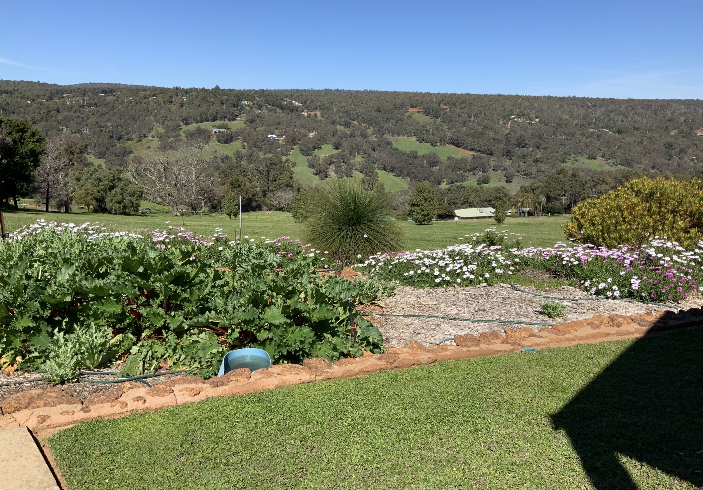
Orchards, Farming & The Area’s Italian Influence
Roleystone’s identity has been heavily shaped by its long orchard and farming history, particularly throughout the areas connecting across into neighbouring Karragullen.
For decades, the district was known for orchards producing stone fruit, citrus and other produce throughout the Hills. Terraced orchards and older fruit-growing properties became a defining part of the landscape, and many still remain today.
The area became home to a strong migrant farming community over the years, particularly Italian families who played a major role in developing and maintaining many of the orchards throughout Roleystone and Karragullen.
That agricultural history still forms an important part of the area’s identity and character. Even as many former orchard properties have gradually transitioned into lifestyle homes and larger residential holdings, the influence of the district’s farming past remains visible throughout the Hills landscape.
Long-time locals still strongly associate parts of Roleystone and Karragullen with:
orchards and fruit trees
terraced hillsides
roadside produce stalls
family-owned farming properties
seasonal fruit picking
agricultural traditions passed through generations
That combination of Hills lifestyle, community history and agricultural heritage is a major part of what gives Roleystone its unique identity compared to newer suburban developments around Perth.
Understanding Roleystone’s Different Areas
One of the reasons Roleystone attracts such a broad range of buyers is because the suburb contains several very different pockets and property styles.
Larger Acreage & Lifestyle Holdings
Parts of Roleystone feature larger acreage properties with workshops, horse facilities, orchards and heavily treed landscapes.
These areas are especially popular with horse owners, tradies needing space, buyers wanting privacy, families chasing a true Hills lifestyle, and buyers upgrading from suburban blocks.
Many properties throughout these areas offer valley views, natural bush settings and significant separation from neighbouring homes.
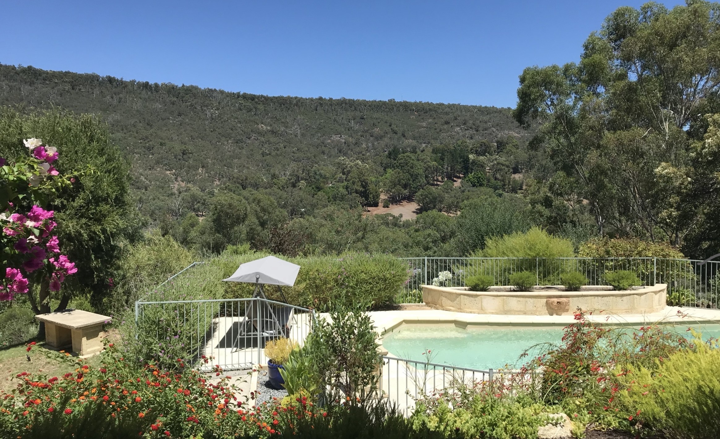
Elevated Valley View Pockets
Some parts of Roleystone are highly sought after because of their elevated positioning and sweeping views across the valleys, forest canopy and rolling Hills landscape.
These homes tend to attract buyers specifically looking for sunsets across the valleys, outdoor entertaining, architectural Hills homes, privacy, tree-lined outlooks, cooler Hills conditions and natural bushland scenery.
Well-positioned homes with valley views and strong natural outlooks often generate particularly strong buyer competition.
Village & Community-Oriented Areas
The central village area around Brookton Highway and Soldiers Road forms an important community hub within Roleystone.
This precinct includes the historic Brackenridge Village area, which sits within the recognised Roleystone Historic Precinct. The area developed from the 1920s onwards and remains an important part of the suburb’s identity today.
The precinct historically included the local co-operative store, butcher shop, post office and other small businesses that serviced the growing Hills community. Unlike many suburban shopping strips, the village area still retains a distinctly local Hills atmosphere and remains a well-known gathering point within the community.
Village Centre & Local Amenities
Unlike many Hills suburbs that rely heavily on neighbouring areas for day-to-day services, Roleystone has its own established local shopping precinct centred around Jarrah Road.
The Roleystone Shopping Centre and surrounding village area provide a range of everyday conveniences including:
grocery shopping
cafés and takeaway options
pharmacy services
medical and professional services
local specialty businesses
For many residents, that local village atmosphere is part of the suburb’s appeal. The shopping precinct still feels community-focused rather than heavily commercialised, reinforcing the small-town Hills character Roleystone is known for.
The suburb also remains within easy reach of larger commercial centres including Kelmscott, Stargate Shopping Centre and Armadale Central.
Araluen Botanic Park & The Tulip Festival
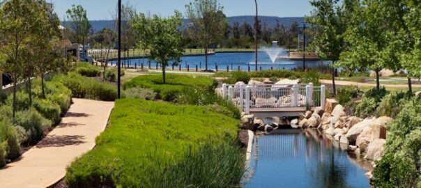
One of Roleystone’s best-known attractions — and one of Perth’s most iconic spring destinations — is Araluen Botanic Park.
Located within the Brookton Valley area of Roleystone, Araluen Botanic Park has been operating since 1930 and has become internationally recognised for its annual Springtime Tulip Festival, which attracts thousands of visitors to the Perth Hills every spring.
The gardens themselves combine landscaped gardens, waterfalls, streams, bushland and walking trails throughout a sheltered valley setting.
During spring, the annual Tulip Festival transforms the park into one of Western Australia’s most photographed seasonal attractions, with more than 250,000 tulips and tens of thousands of additional spring bulbs blooming throughout the gardens.
For locals, Araluen is more than just a tourist attraction. It forms part of the suburb’s identity and lifestyle, with residents enjoying picnics, walking trails, weddings and events, seasonal festivals, concerts and outdoor performances, and gardens and natural scenery year-round.
The park also contributes significantly to Roleystone’s reputation as one of Perth’s most scenic Hills suburbs.
Araluen Estate, Golf Course & Resort Lifestyle
One of Roleystone’s most recognisable lifestyle destinations is Araluen Estate, located within the Brookton Valley area of the suburb.
Originally developed during the 1990s, Araluen Estate combines one of Western Australia’s best-known golf courses with a luxury residential estate, clubhouse, restaurant and function venue surrounded by native bushland and dramatic valley scenery.
The championship golf course opened in 1994 and was designed by renowned golf course architect Michael Coate together with Australian touring professional Roger Mackay. Built throughout steep natural terrain surrounded by forest and the Canning River valley system, the course quickly developed a reputation as one of the most visually striking golf courses in Western Australia.
Today, Araluen Estate remains highly regarded not only for golf, but also for weddings and events, restaurant and clubhouse facilities, luxury Hills living, premium homes integrated throughout the estate, and natural scenery and valley views.
The residential estate itself operates under specific design guidelines intended to maintain a low-density, high-quality Hills environment integrated with the surrounding landscape.
For buyers, the Araluen precinct offers a very different style of living compared to other parts of Roleystone, combining executive-style homes, golf course frontage, bushland surroundings, a resort-style atmosphere and premium Hills living.
The estate also sits adjacent to the historic Araluen Botanic Park, helping form one of the most recognisable lifestyle precincts within the Perth Hills.
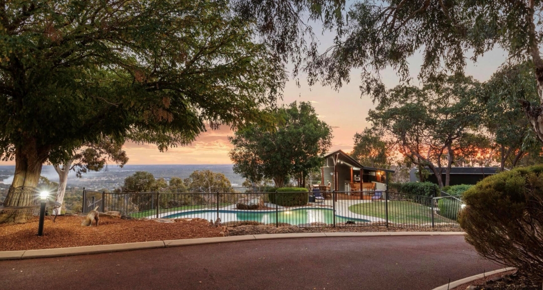
Resort-style living overlooking the Canning Valley.
What Buyers Love About Roleystone
Roleystone attracts buyers looking for lifestyle first.
People move here because they want space, privacy, trees, wildlife, character homes, workshops and sheds, larger blocks, orchards and gardens, a quieter pace of life, and a stronger community connection.
The suburb is particularly popular with buyers wanting to escape dense suburban estates, small blocks, traffic congestion and cookie-cutter developments.
One of the biggest attractions is that many Roleystone properties feel genuinely unique. Buyers are often choosing between architect-designed Hills homes, renovated character properties, bushland retreats, lifestyle acreages, horse properties, orchard properties and modern family homes with valley views.
That individuality is a major part of the suburb’s appeal.
Nature, Trails & Outdoor Lifestyle
Roleystone is heavily connected to the surrounding natural landscape and outdoor lifestyle.
The suburb is surrounded by bushland, walking trails and national park areas, giving residents direct access to some of the Hills’ best natural scenery.
One of the best-known local attractions is Roley Pools, located along the Canning River. The area was a popular swimming and picnic destination from the early 1900s and remains one of the suburb’s most recognised natural landmarks today.
Residents also enjoy hiking trails, mountain biking, horse riding, birdlife and native wildlife, waterfalls and granite outcrops, and bushwalking throughout the Hills.
For many locals, the natural environment is one of the biggest reasons they stay in Roleystone long-term.
Community & Village Atmosphere
Roleystone has one of the strongest community identities in the Perth Hills.
Unlike many newer suburbs, there is a long-standing sense of local involvement and connection throughout the area.
The suburb is known for volunteer community groups, strong local sporting clubs, local arts and creative communities, school involvement, Hills events and markets, local fire brigades and long-established family networks.
The village precinct around Brookton Highway and Soldiers Road remains an important meeting place for the community and contributes heavily to the suburb’s identity.
For many buyers, that sense of belonging becomes just as important as the property itself.
Schools & Family Appeal
Roleystone is particularly popular with families wanting a Hills upbringing for their children while still remaining connected to Perth.
The suburb offers access to Roleystone Community College — a Kindergarten to Year 10 Independent Public School set in jarrah bushland, known locally for its specialist Film and Television program. Secondary students continuing through Years 11 and 12 typically transition to nearby high schools.
Other educational and community resources include:
local primary schools
Southern Hills Christian College nearby
sporting clubs and recreation facilities
music and arts programs
large outdoor spaces and parks
Many families are specifically attracted to the combination of larger blocks, quieter streets, outdoor lifestyle, stronger community feel and reduced suburban density.
Important Things Buyers Should Understand
Roleystone is not a standard suburban market, and buyers need to understand the practical side of Hills living.
Depending on the property, buyers may need to consider:
bushfire preparedness
BAL (Bushfire Attack Level) ratings
septic systems
water tanks and bore water
steep driveways
slope and drainage
retaining requirements
tree maintenance
wildlife
internet and mobile coverage in some pockets
For serious Hills buyers, these are generally considered part of the lifestyle rather than drawbacks. However, local knowledge becomes extremely important because conditions can vary dramatically from one street to another.
Roleystone Market Snapshot
Roleystone remains one of the Perth Hills’ strongest-performing lifestyle markets.
Recent figures show:
approximately 30 homes sold in the previous six months
around 4 homes available for sale
average days on market sitting at 12 days
median sale price reaching approximately $1,250,000
median values increasing 32% over 12 months
Recent sales throughout Roleystone have ranged from smaller lifestyle homes through to premium acreage properties.
Well-positioned homes with valley views, usable land, workshops or strong lifestyle appeal continue to attract significant buyer competition.
For the most current market data, see our latest Roleystone Market Update Report. [Link to market update reports page once live.]
Selling in Roleystone
Selling a property in Roleystone requires a very different strategy compared to selling a standard suburban home.
Buyers are not simply comparing bedroom counts and floorplans. They are comparing:
views
privacy
land usability
tree coverage
water setup
workshops and sheds
entertaining areas
bushland setting
driveway access
orchard potential
architectural character
overall lifestyle appeal
The emotional side of the property matters heavily in Roleystone, which means presentation, photography and storytelling become especially important.
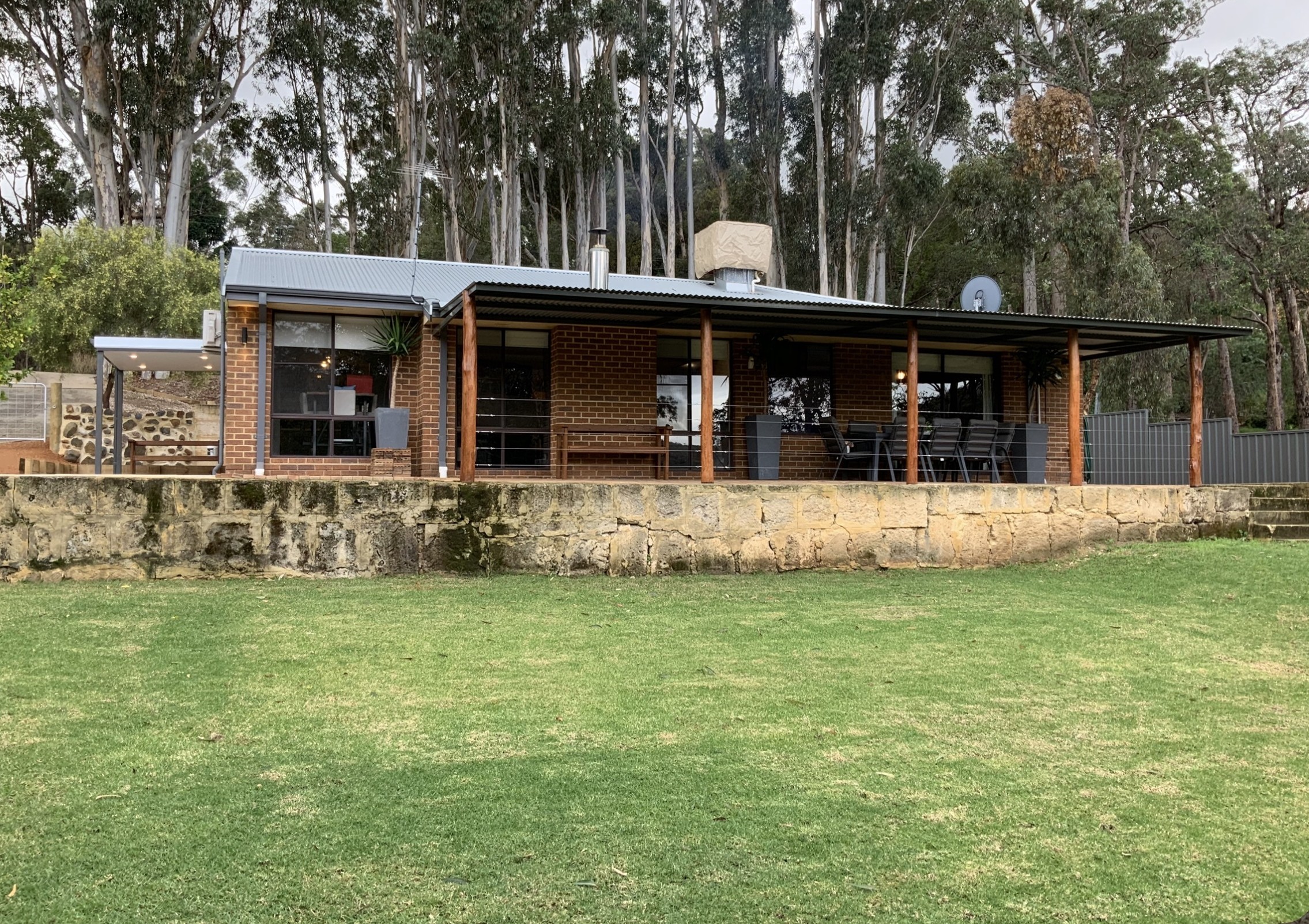
Classic Roleystone lifestyle living.
Why Work With Naked Real Estate
Experience matters in any market. The wrong choice of agent can cost you thousands — so why risk your biggest asset?
Brendan Leahy has been selling property throughout the Perth Hills since 2002. He founded his own agency in 2006 and rebranded to Naked Real Estate in 2012, with a continued focus on Roleystone, Bedfordale, Mount Nasura, Mount Richon, Kelmscott and Seville Grove.
With over 1,503 personal home sales and more than $760 million in total sales value across his career, Brendan brings genuine local experience to a market where property differences can vary enormously from one street to the next.
In a suburb built around character, history and lifestyle, local knowledge matters. Understanding the different pockets, buyer types, view corridors, orchard areas, land usability and lifestyle appeal can make a significant difference when it comes to pricing and marketing strategy.
In Roleystone, no two properties are ever truly the same — and that’s exactly the kind of market where experience and local understanding pay off.
A foothills suburb that changes from one end to the other
Mount Richon is one of the more distinctive foothills suburbs in the Perth Hills. Long, narrow, and bound by Albany Highway and South Western Highway, it offers older established homes, larger half-acre blocks, valley outlooks, creekline properties, newer homes in Richon Heights, and convenient access to Armadale shops, schools and transport.
The key thing buyers and sellers need to understand: Mount Richon is not one single market.
It is best understood in three main sections — each with different buyers, different price points, and different marketing requirements:
1. Richon Heights — southern section, newer homes, half-acre to multi-acre blocks
2. Middle Mount Richon — north of Hillside Garden Village, established half-acre lifestyle
3. Northern Mount Richon — closer to Armadale, with a distinct east/west character split
Each pocket attracts different buyers, and needs to be priced and marketed differently.
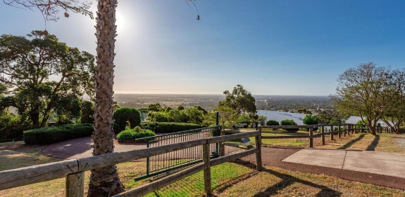
Mt Richon is known for elevated homes, larger blocks and sweeping views across the coastal plain.
Mount Richon market — right now
Past 6 months (May 2026):
Median sale price: $1,010,000
12-month median growth: +25.3%
5-year median growth: +122.5%
Average days on market: 17
Homes sold: 11
Homes currently for sale: 1
Source: CoreLogic RPData / PriceFinder
Mount Richon is currently one of the tightest property markets in the Perth Hills. With just one home currently available for sale and properties moving in an average of 17 days, sellers are operating in an extreme low-supply environment.
Median values are up +25.3% over the past 12 months and have more than doubled (+122.5%) over the past five years.
Recent sales have ranged from $573,000 for a smaller-block property up to $1,557,500 for a 2,506m2 home on Talus Drive — a spread that reflects how dramatically Mount Richon changes from pocket to pocket.
Many Mt Richon homes enjoy elevated outlooks across the foothills, valley and coastal plain.
Where Mount Richon sits
Mount Richon sits along the foothills near Armadale, positioned between Albany Highway and South Western Highway. The location gives buyers access to the Perth Hills lifestyle while remaining close to everyday services.
Key location points:
Albany HighwaySouth Western Highway
Armadale Shopping Centre
Armadale train station
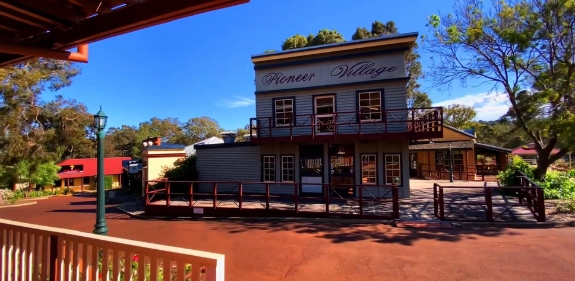
Pioneer Village School
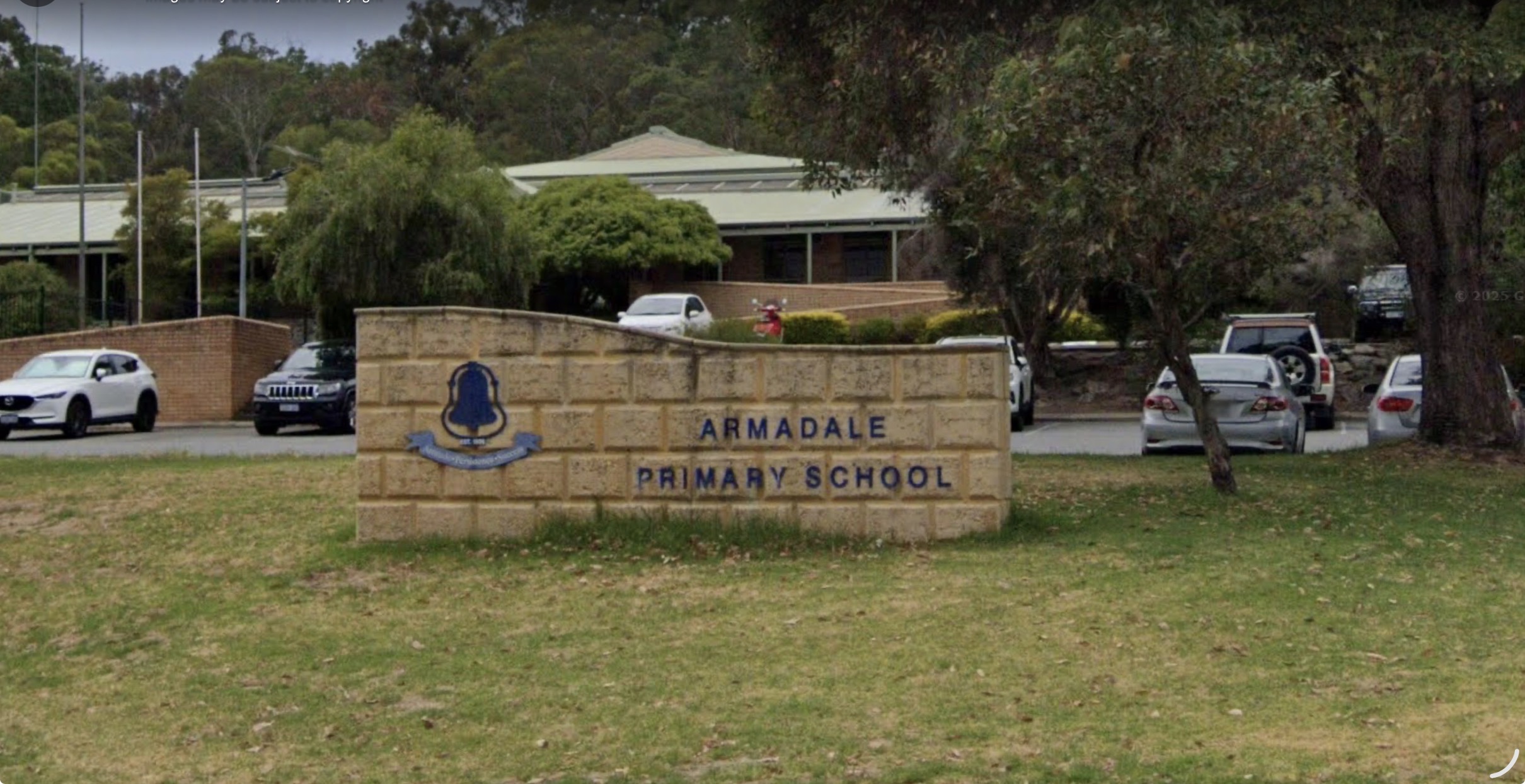
Armadale Primary School
Armadale Senior High School
Bedfordale Hill Road
Hillside Garden Village
Access to surrounding suburbs including Armadale, Mount Nasura, Bedfordale and Roleystone, Mount Richon works well for buyers who want a Hills feel without being disconnected from schools, shops, transport and services.
Pioneer Village adds to Mt Richon’s local character and connects the suburb closely with Armadale’s historic foothills identity.
Understanding Mount Richon’s different pockets
Because of its long, narrow shape and changing elevation, properties in Mount Richon vary significantly depending on where they sit.
Some homes are older and closer to Armadale’s shops and transport. Others sit on larger half-acre blocks with views, creekline outlooks and a stronger lifestyle feel. In the southern pocket of Richon Heights, some properties sit on two and three-acre parcels.
This is why suburb averages do not tell the full story in Mount Richon. A home on a smaller block closer to Armadale should not be compared directly with a half-acre hillside home or a larger Richon Heights property with views.
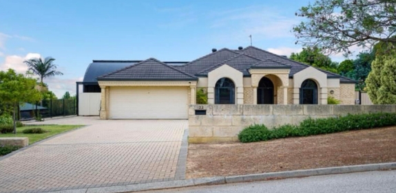
Richon Heights offers larger homes, bigger blocks and a quieter foothills lifestyle.
1. Richon Heights — southern Mount Richon
The far southern section of Mount Richon, south of Hillside Garden Village, is commonly known as Richon Heights.
Homes here are generally newer, and many sit on half-acre blocks. Some properties around Cooliabberra Drive sit on two and three-acre parcels. The pocket has strong lifestyle appeal because of its block sizes, setting and outlook — some homes enjoy views south across the hills, while others capture views west across the coastal plain with stunning sunsets.
2. Middle Mount Richon — north of Hillside Garden Village
The middle section of Mount Richon sits north of Hillside Garden Village and runs through toward Bedfordale Hill Road.
This area still includes many half-acre blocks and larger homes, giving it strong appeal for buyers who want space without moving too far from Armadale and surrounding amenities.
Compared with the northern section closer to town, this middle pocket has more of a lifestyle feel while remaining practical. Marketing angle: usable half-acre land, larger homes, balance of lifestyle and convenience.
3. Northern Mount Richon — closer to Armadale
The northern section of Mount Richon is different again. It is closer to Armadale Shopping Centre, Armadale train station and surrounding schools — generally more practical and convenient for buyers who want walkability.
Within this northern section, there are two distinct sides:
Western / Armadale side — older homes on generally smaller blocks. The major advantage is convenience: within walking distance of Armadale Shopping Centre, Armadale train station, Armadale Primary School and Armadale Senior High School. This pocket appeals to buyers who value location, access and established value.
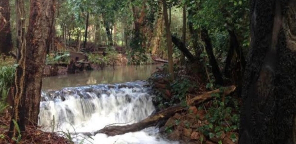
Some eastern pockets of Mt Richon back onto natural creekline areas, adding privacy and a stronger hills feel.
Eastern side / creekline and valley views — half-acre blocks with a stronger lifestyle feel. Some properties have wonderful valley views, others back onto a creekline. Still within walking distance of Pioneer Village School, Armadale Primary School and Armadale Senior High School. One of Mount Richon’s strongest pockets because it combines lifestyle, school access and convenience.
Richon offers half-acre blocks, valley views and creekline properties within reach of local schools.
Who buys in Mount Richon
Mount Richon attracts a wide range of buyers because each pocket offers something different:
Families and upsizers wanting half-acre space
Buyers chasing views, sunsets or creekline outlooks
Buyers priced out of Bedfordale or Roleystone
Renovators looking at older northern homes
Professional couples wanting walkability to Armadale Lifestyle buyers wanting space without isolation
The buyer for an older Armadale-side home is not the same buyer chasing a Richon Heights property with views.
Marketing the right property to the right buyer pool is the difference between a strong result and an underwhelming one.
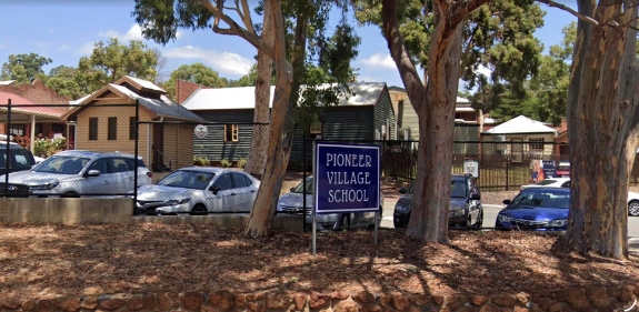
Parts of Mt Richon are within easy reach of Pioneer Village School, Armadale Primary School and local amenities.
Schools and education
Mount Richon is well placed for local schooling, particularly in the northern section.
Nearby schools include:
Pioneer Village School
Armadale Primary School
Armadale Senior High School
The eastern side of the northern section is especially well positioned for families wanting school access while enjoying a larger-block lifestyle.
Selling in Mount Richon — pocket-by-pocket strategy
Selling in Mount Richon requires proper local positioning. The right marketing angle depends entirely on which pocket the property belongs to:
A Richon Heights home is typically marketed around larger blocks, newer homes, views and sunset lifestyle.
A middle Mount Richon home is positioned around half-acre space, larger homes and lifestyle convenience.
A northern, western home (closer to Armadale) is marketed around walkability, schools, shops and transport.
An eastern northern home is marketed around valley views, creekline setting, half-acre blocks and school access.
Use the wrong angle and the property can be undersold, misunderstood or compared against the wrong homes.
Selected elevated homes in Mt Richon can capture impressive city and coastal plain views.
Why work with Naked Real Estate
Experience matters in any market. The wrong choice of agent can cost you thousands — so why risk your biggest asset?
Brendan Leahy has been selling property throughout the Perth Hills since 2002. He founded his own agency in 2006 and rebranded to Naked Real Estate in 2012, with a continued focus on Bedfordale, Kelmscott, Roleystone, Mount Nasura, Mount Richon and Seville Grove.
With over 1,503 personal home sales and more than $760 million in total sales value across his career — and named 2023 Agency of the Year for Bedfordale, Kelmscott and Mount Nasura — Brendan brings genuine local experience to a market where property differences can vary enormously from one street to the next.
In Mount Richon, local knowledge matters. Understanding the different precincts, buyer types, land usability and lifestyle appeal can make a significant difference when it comes to both pricing and marketing strategy.
Truth. Strategy. Sold.
Thinking of selling in Mount Richon?
Speak with Brendan Leahy at Naked Real Estate for direct, practical advice on where your property sits in today’s market.
Brendan Leahy 0439 998 867 brendan@nakedrealestate.com.au
Unit 1/198 Brookton Highway, Kelmscott WA 6111
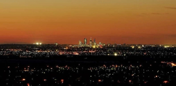
MountNasura is one of the most interesting suburbs along the Perth Hills scarp because it offers a rare mix of elevation, outlook, established homes and everyday convenience.
It is close to Armadale Hospital, Armadale shopping centres, public transport, local pubs, schools and the foothills, but still has the character and privacy buyers often chase in the hills.
The key thing to understand is this: MountNasura is not one single type of market. It changes significantly depending on where the property sits.
Where MountNasura Sits
MountNasura sits on the eastern side of Armadale, positioned along the foothills of the Darling Scarp.
Key location points:
– Armadale Hospital – Armadale Shopping City – Armadale train station – Albany Highway access – South Western Highway access – Narrogin Inn – Elizabethan Village Pub – Armadale Primary School – Pioneer Village School – hills and scarp lifestyle
MountNasura works for buyers who want a hills feel without being disconnected from daily convenience.
Mount Nasura offers a rare mix of hills character, established homes and everyday convenience close to Armadale’s major amenities.
Understanding MountNasura’s Different Pockets
MountNasura is not a one-size-fits-all suburb. Buyers need to understand the different pockets before they judge value.
The suburb is broadly split into several different pockets, including lower MountNasura, the Blackwood Drive hillside sections and the eastern boundary around Paterson Road.
Lower MountNasura
The lower section of MountNasura is generally older and made up of smaller blocks, but it has some major practical advantages.
This part of the suburb is closer to Armadale Hospital, the main shopping centres, public transport and local amenities. It is also generally connected to deep sewer, which can be an important factor for buyers comparing properties across different parts of the suburb.
Key features:
– older established homes – generally smaller blocks – deep sewer connection – closer to Armadale Hospital – closer to Armadale shops – closer to Armadale train station – easier access to Albany Highway and South Western Highway – walkable to local amenities
Lower MountNasura is practical. It suits buyers who want the MountNasura address and lifestyle, but still want convenience.
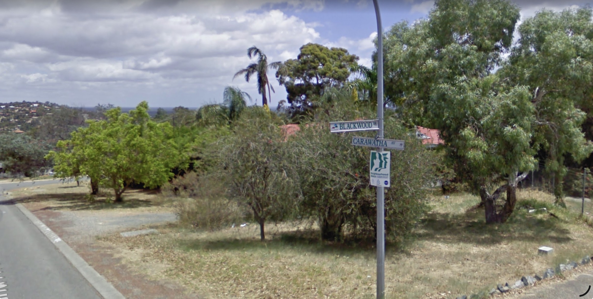
Southern Side Of Blackwood Drive
The southern side of Blackwood Drive has a different feel. These properties tend to offer more of the elevated hills lifestyle that buyers associate with MountNasura.
Homes in this pocket can capture views across the valley, giving them a stronger lifestyle feel and a sense of separation from the busier lower sections.
Key features:
– elevated position – valley outlook – hillside setting – stronger lifestyle appeal – more privacy and outlook – appeal to buyers wanting a Perth Hills feel
This pocket is often about outlook, space and lifestyle.
Northern Side Of Blackwood Drive
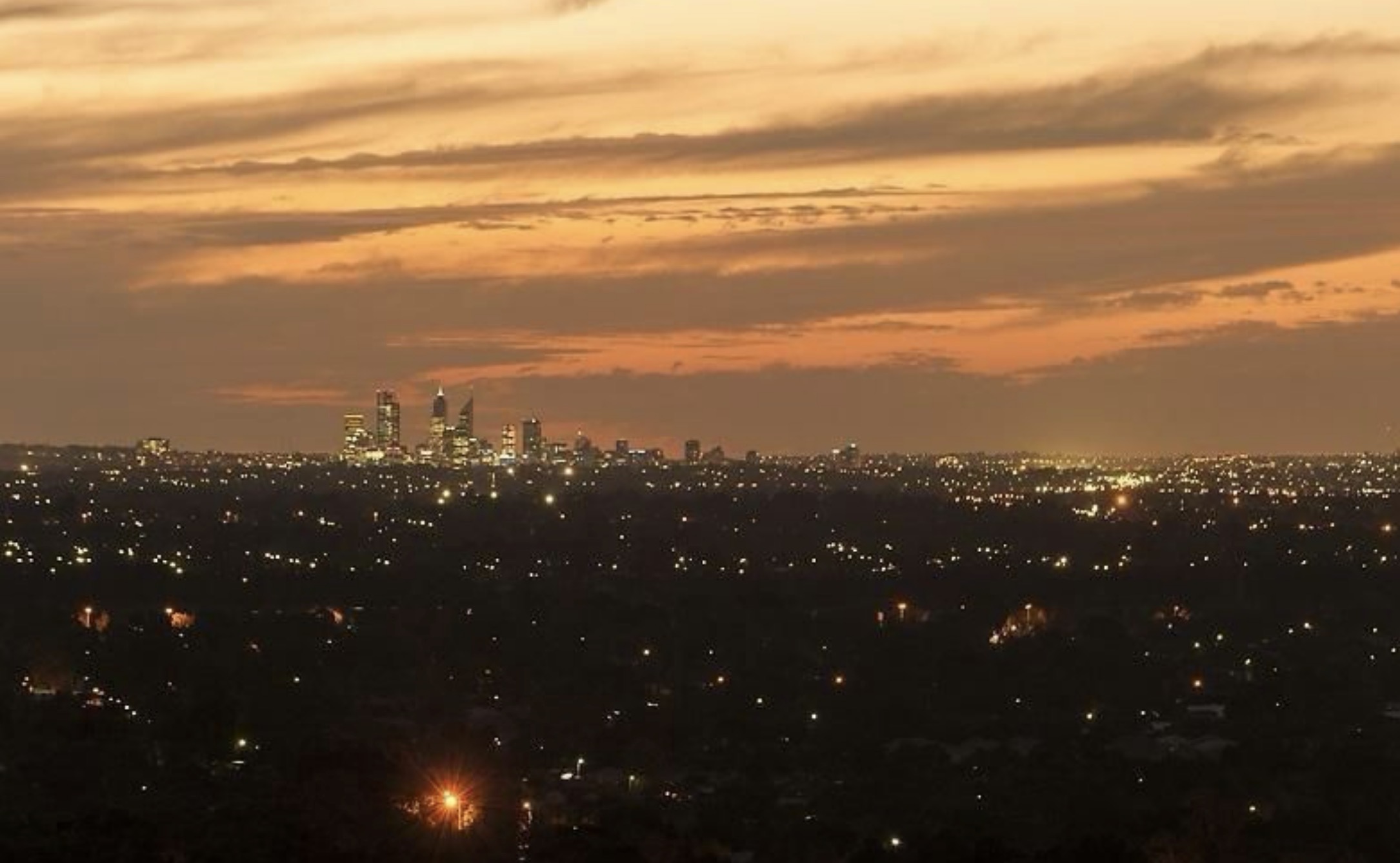
The northern side of Blackwood Drive is one of MountNasura’s strongest selling points.
Many properties in this pocket can capture views toward the city and across the coastal plain. What makes this especially valuable is the orientation.
In many Perth Hills suburbs, homes with city views face west, which means they look directly into the harsh afternoon sun. MountNasura is different. Properties facing the city can have a north-facing outlook, which is a rare advantage along the scarp.
That matters.
A north-facing outlook can provide a more usable orientation, better natural light and less exposure to direct western afternoon sun compared with other scarp suburbs.
Key features:
– city views – coastal plain views – north-facing outlook toward the city – rare scarp orientation advantage – elevated position – strong buyer appeal
This is one of MountNasura’s most important local differences and should not be ignored when selling.
Some northern Mount Nasura homes capture city and coastal plain views with a rare north-facing orientation.
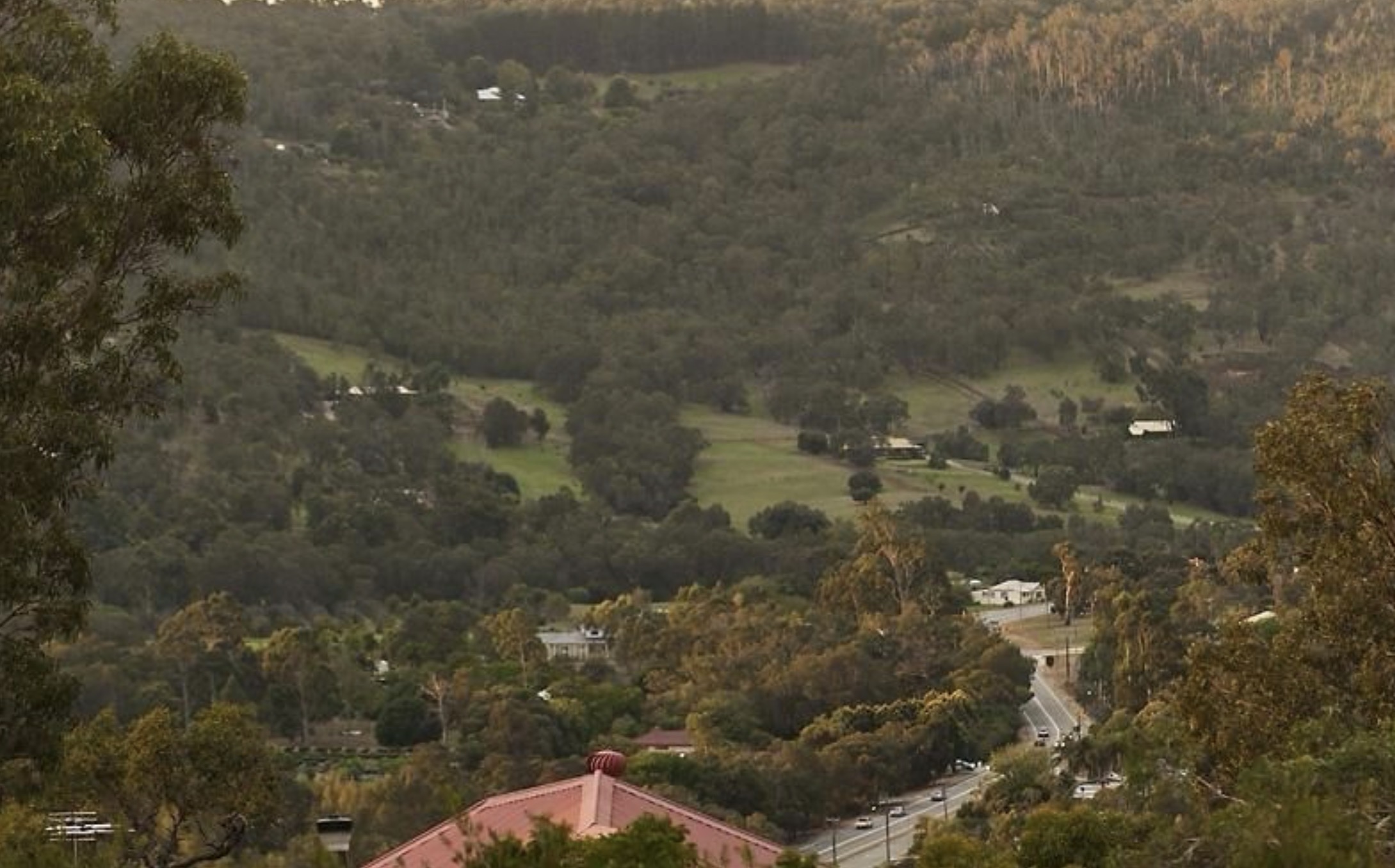
Eastern Boundary / Paterson Road
The eastern boundary of MountNasura runs along Paterson Road, and this pocket has its own appeal.
Properties in this area can have a lovely outlook over the Brookton Valley, giving them a more open, scenic feel compared with the lower sections of the suburb.
Key features:
– Paterson Road eastern boundary – outlook over Brookton Valley – more open valley feel – strong lifestyle appeal – quieter hills-edge position – different buyer appeal from lower MountNasura
This pocket should not be lumped in with the lower section or the Blackwood Drive view properties. It has a different outlook and a different lifestyle feel.
Homes along Mount Nasura’s eastern boundary near Paterson Road can enjoy a scenic outlook over Brookton Valley.
Who Buys In MountNasura
MountNasura attracts several different buyer groups because the suburb offers both convenience and lifestyle.
Common buyer groups include:
– families – upsizers – professional couples – hospital workers – buyers priced out of Bedfordale and Roleystone – Perth Hills buyers wanting better convenience – buyers wanting views without being too far from services – renovators – buyers looking for larger or character homes – downsizers wanting a hills feel close to town
MountNasura appeals to buyers who want more than a standard suburban block, but do not want to be isolated.
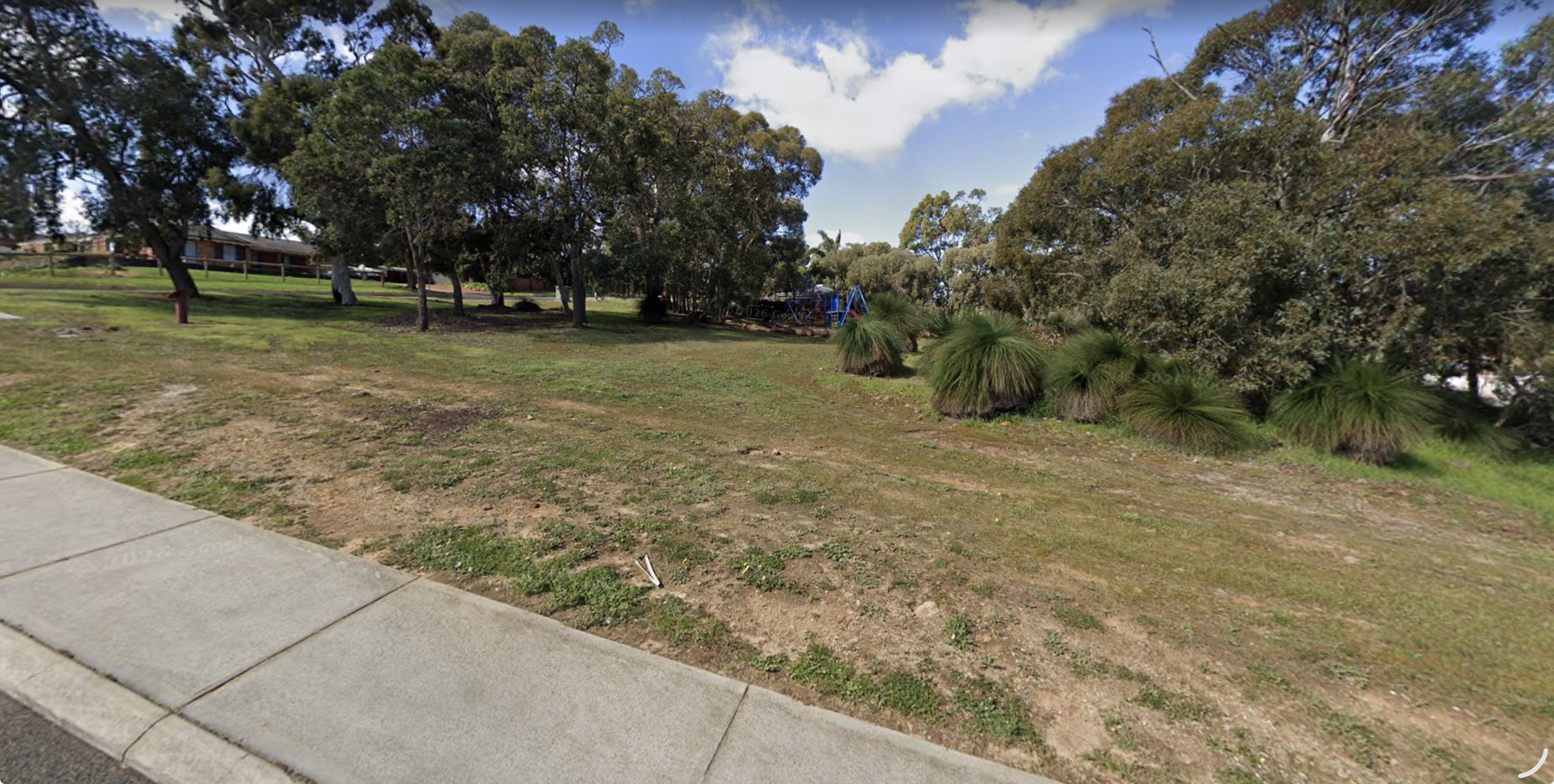
Mazzega park – Mount Nasura appeals to buyers wanting hills character, established homes and easy access to everyday services
Schools & Education
MountNasura is well placed for local schooling and surrounding education options.
Nearby schools include:
– Armadale Primary School – Pioneer Village School – surrounding schools across Armadale, Kelmscott and the Perth Hills
Armadale Primary School and Pioneer Village School both have strong local reputations, which is important for families considering the area.
The suburb’s location also gives families access to nearby education options in Armadale, Kelmscott and surrounding suburbs.
Lifestyle & Local Convenience
MountNasura’s biggest strength is that it offers hills character without losing everyday convenience.
Many homes are within a healthy walk of:
– Armadale shops – Armadale train station – Armadale Hospital – Narrogin Inn – Elizabethan Village Pub – local parks and reserves
This gives MountNasura a practical edge over some more isolated hills suburbs.
Buyers can enjoy elevation, trees and outlook while still being close to services, shopping, transport and hospitality.
What Locals Like About MountNasura
Locals are often drawn to MountNasura because it offers a balance that is hard to find.
Key local appeal:
– established trees – hillside views – character homes – larger-feel blocks in elevated pockets – deep sewer in lower sections – close to hospital and shopping – walkability to Armadale amenities – strong local schools nearby – quieter residential feel – access to the Perth Hills lifestyle
MountNasura gives buyers a foothills lifestyle without pushing them too far away from daily necessities.
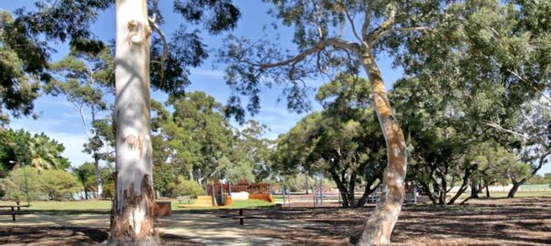
Established trees, elevation and convenience are a major part of Mount Nasura’s appeal.
Important Things Buyers Should Understand
MountNasura changes significantly from street to street.
Buyers should understand:
– lower MountNasura vs hillside MountNasura – sewer connection differences – block size variation – slope and driveway access – views and orientation – older housing stock – renovation considerations – proximity to hospital and shops – traffic exposure on some roads – buyer demand differences between pockets
A property in lower MountNasura should not be compared blindly with an elevated home around Blackwood Drive or a Paterson Road home with a Brookton Valley outlook.
The location, orientation, views, block size, sewer connection and access can all change the value.
This is why local knowledge matters.
MountNasura Market Snapshot
MountNasura has seen strong buyer demand and limited available stock.
According to the February/March 2026 MountNasura Market Update Report, there were 26 homes sold in the previous six months, only 6 homes for sale at the time of the report, an average of 13 days on market, a highest sale price of $1,680,000, a lowest sale price of $700,000, and a six-month median sale price of $969,000. The report also recorded a 23% change in median value over the previous 12 months and a 112% change over the previous five years.
Key market points:
– 26 homes sold in the past six months – 6 homes for sale at the time of reporting – 13 average days on market – $1,680,000 highest sale price – $700,000 lowest sale price – $969,000 median sale price – 23% median value change over 12 months – 112% median value change over 5 years
This shows how tight the MountNasura market has been, especially when quality homes are positioned correctly.
Selling In MountNasura
Selling in MountNasura is not just about quoting a suburb median.
The right selling strategy depends on the property’s exact position.
Important selling factors include:
– lower section, hillside section or eastern boundary pocket – north-facing city outlook – valley views – Brookton Valley outlook – block size – sewer connection – slope and access – renovation level – proximity to hospital and shops – buyer type most likely to compete – whether the home should be positioned as lifestyle, convenience, views or land value
A lower MountNasura home close to deep sewer and shops needs a different strategy from a hillside home with views across the coastal plain or a Paterson Road home overlooking Brookton Valley.
That is where local knowledge becomes the difference between average marketing and sharp positioning.
Why Work With Naked Real Estate In MountNasura
MountNasura is a suburb where local knowledge matters.
The lower section, the Blackwood Drive hillside pockets, the Paterson Road eastern boundary, sewer connection, elevation, city views, valley views, block size and orientation can all change how a property should be marketed.
Brendan Leahy understands these differences because he works this market at street level, not just from suburb data.
With deep local experience, over 1500 personal sales and the Select Date Sale® strategy, Naked Real Estate helps MountNasura sellers position their property correctly, attract the right buyers and create competition.
When experience counts, local knowledge matters.
Thinking of selling in MountNasura?
Speak with Brendan Leahy at Naked Real Estate for direct, practical advice on where your property sits in today’s market.
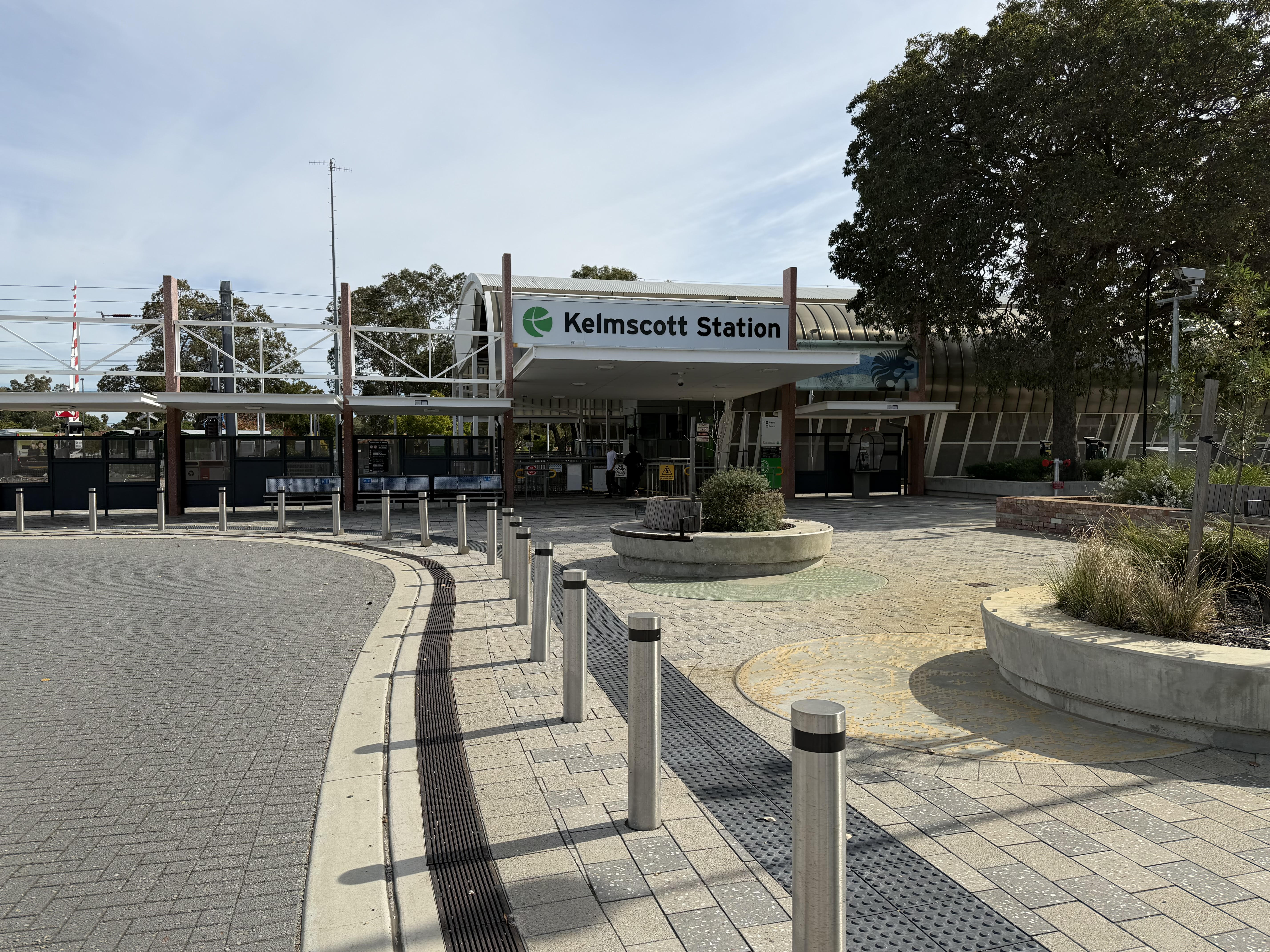
Kelmscott sits about 25 kilometres south-east of Perth, where the suburban flat meets the Darling Scarp foothills. It is one of the older, established parts of the Armadale corridor, with a train station, several schools, large reserves and a genuine spread of housing, from redevelopment blocks to elevated family homes. That variety is exactly why pricing a Kelmscott home well takes local knowledge, not a generic online estimate.
Where Kelmscott sits
Framed by Albany Highway and Tonkin Highway and served by Kelmscott Train Station, the suburb offers straightforward commuting to Perth, quick access to Armadale, and an easy run up into the hills. For many buyers that combination, city access one way and the foothills the other, is the whole appeal,
Kelmscott Station provides easy local transport access, connecting the suburb with surrounding areas and the Perth CBD.
Understanding Kelmscott’s different pockets
Kelmscott is not one market. Broadly it splits into three. The Clifton Hills and hills-side pockets, where elevation and outlook lift value. Central Kelmscott, around the town centre and station, built for convenience and walkability. And the redevelopment and investment pockets, where larger established blocks and zoning variation create subdivision potential. Two homes a few streets apart can attract completely different buyers and completely different prices. If you only take one thing from this page, make it that.
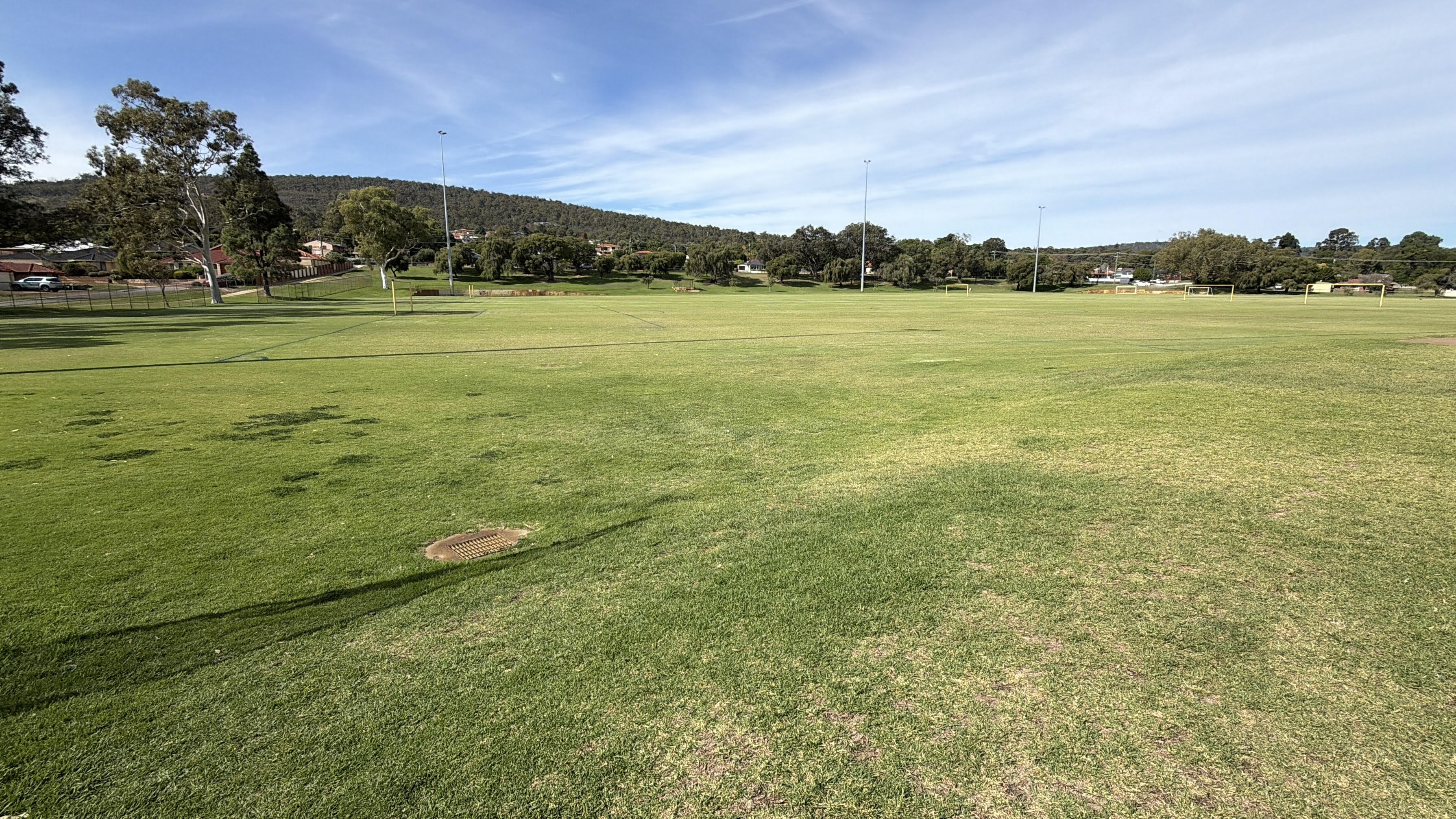
Kelmscott offers wide open green spaces, sporting fields and family-friendly recreation areas close to established homes.
Who buys in Kelmscott
The buyer pool here is deliberately broad: first-home buyers, families, investors and developers, upsizers, and Perth Hills buyers who love the area but have been priced out of Bedfordale or Roleystone. Knowing which of these a specific home suits is what determines the marketing, the campaign and the result.
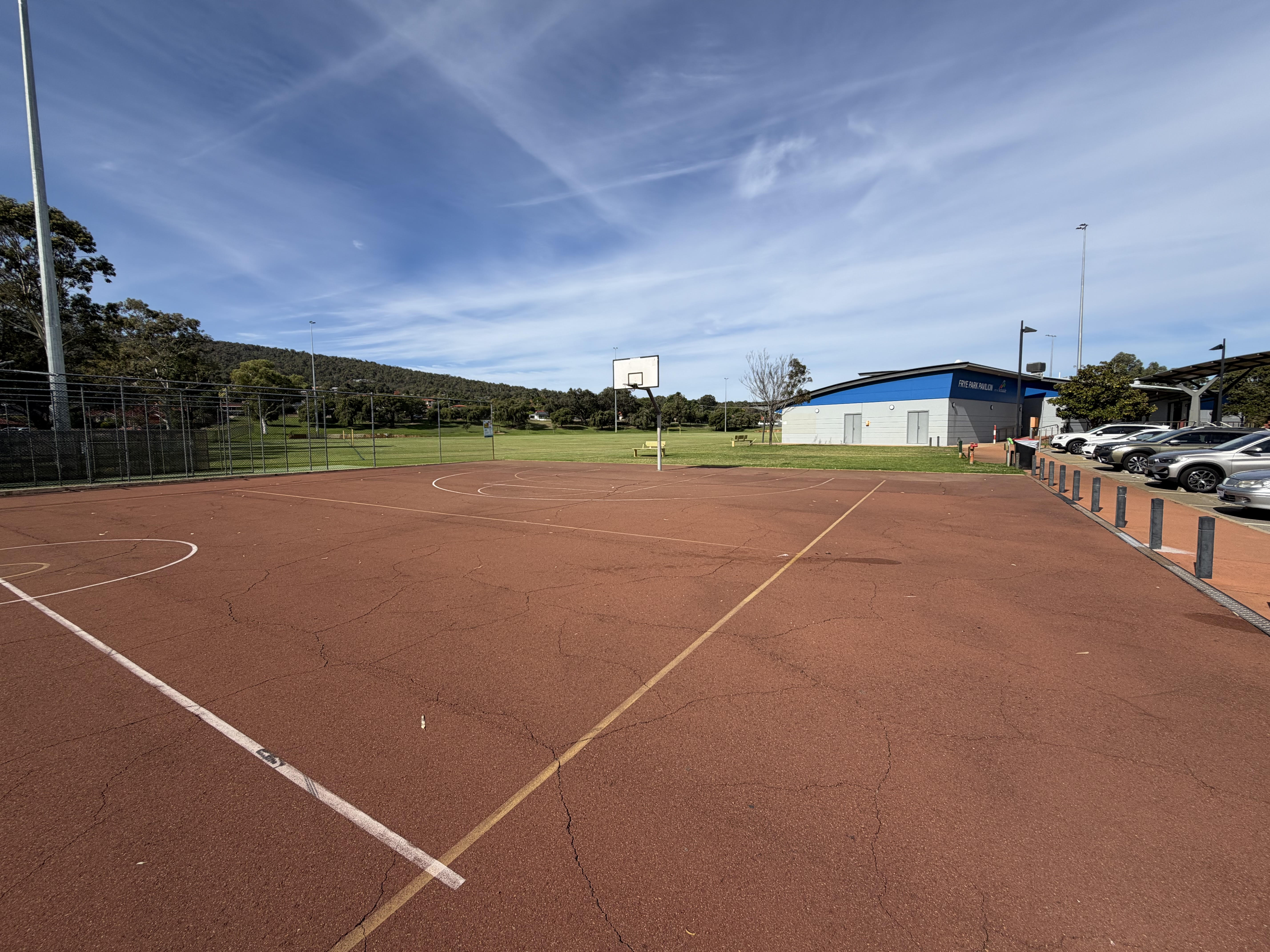
Frye Park is one of Kelmscott’s key community recreation areas, with sporting facilities, open space and local amenities.
Schools and education
Local schools include Kelmscott Senior High School, Kelmscott Primary School and Clifton Hills Primary School. Steady school demand is part of why the established family pockets hold up.
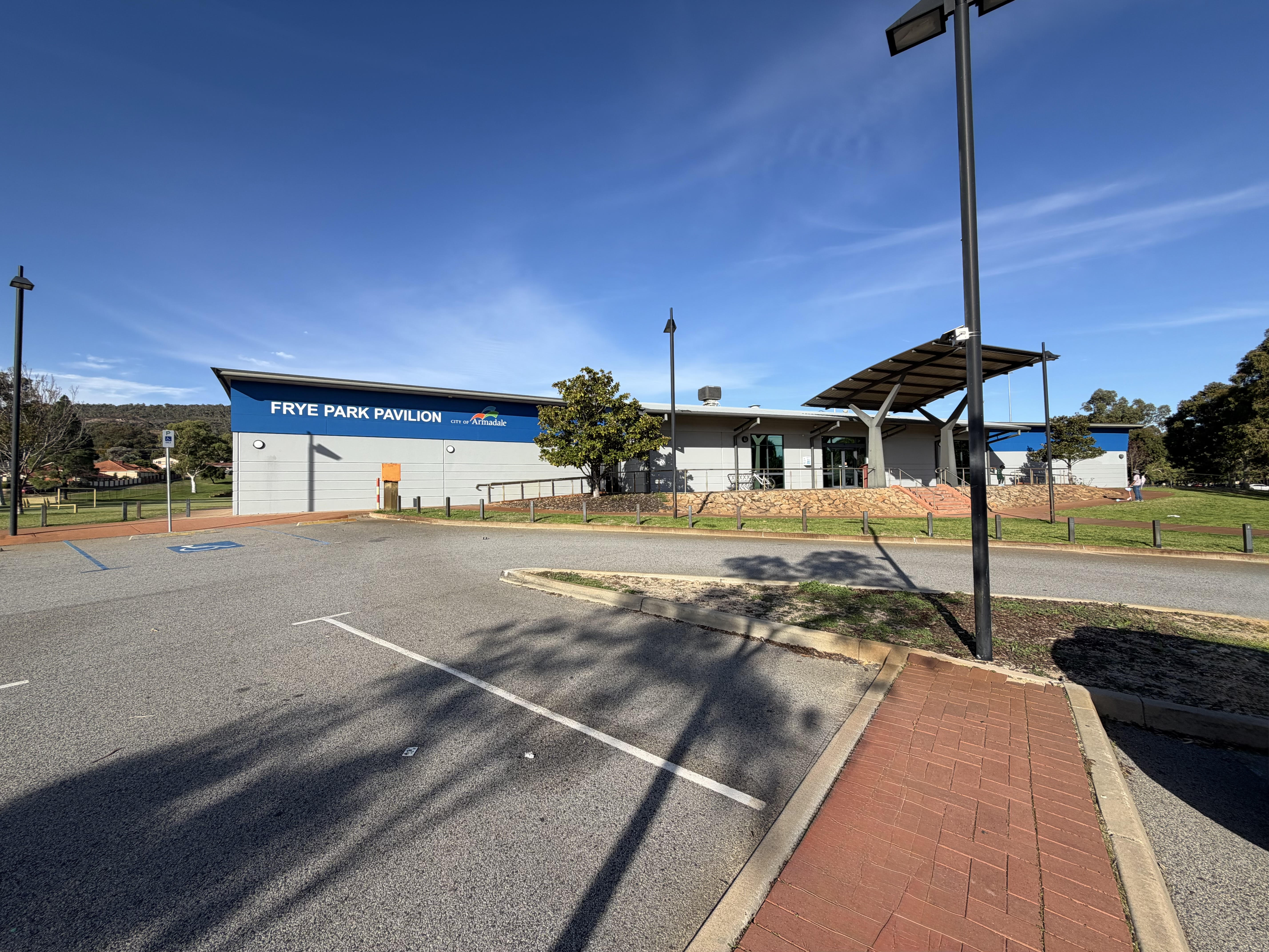
The Frye Park Pavilion supports local sport, events and community activity in the heart of Kelmscott.
Community and local identity
Kelmscott has long-standing roots and a real community identity, anchored by events like the Kelmscott Show and an active local sporting scene. For a lot of owners, that sense of belonging is a bigger reason they stay than any single feature of the house.
Kelmscott’s parklands provide shaded picnic areas, mature trees and quiet green spaces for families and residents to enjoy.
A bit of Kelmscott history, from our front door
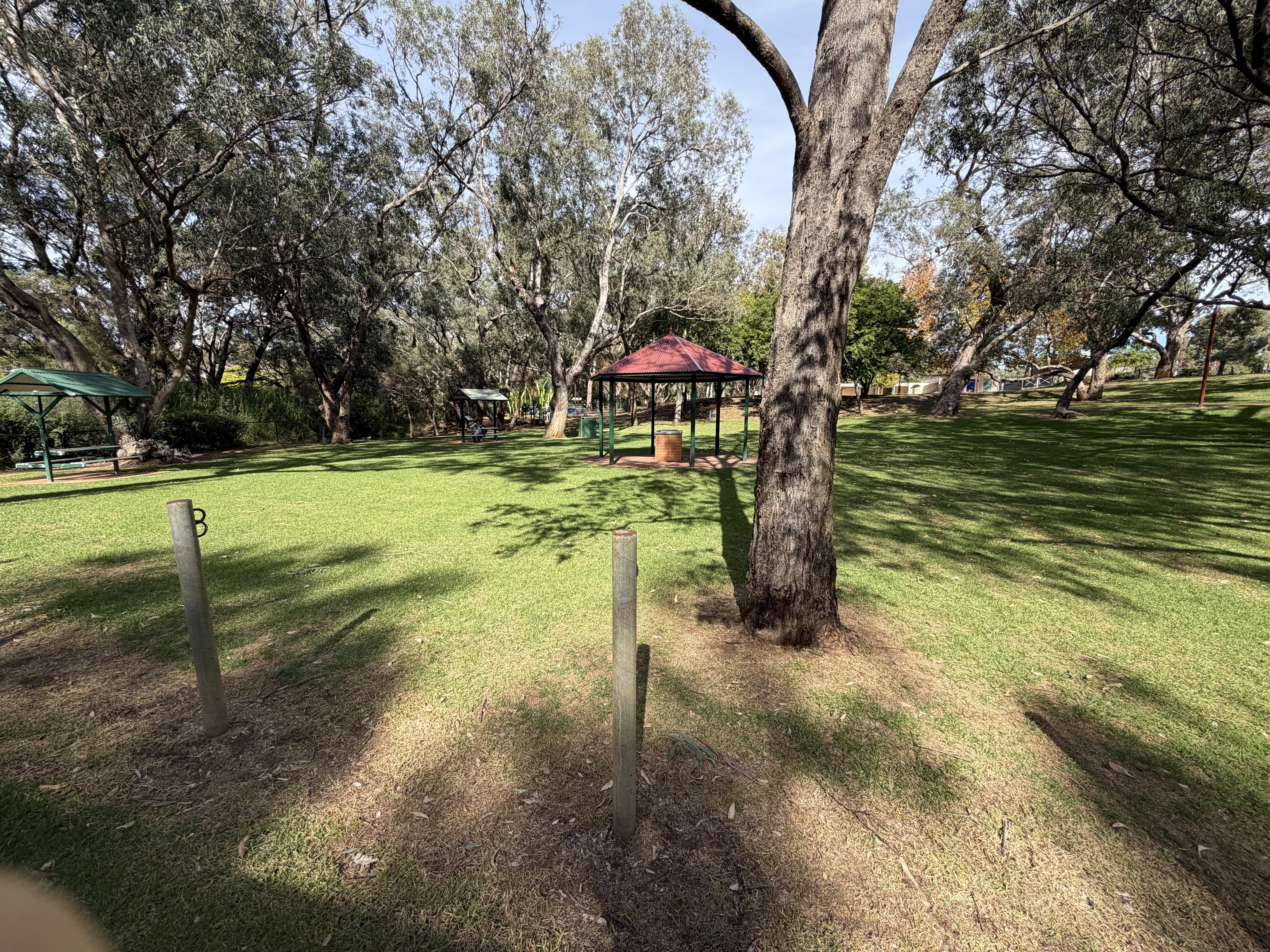
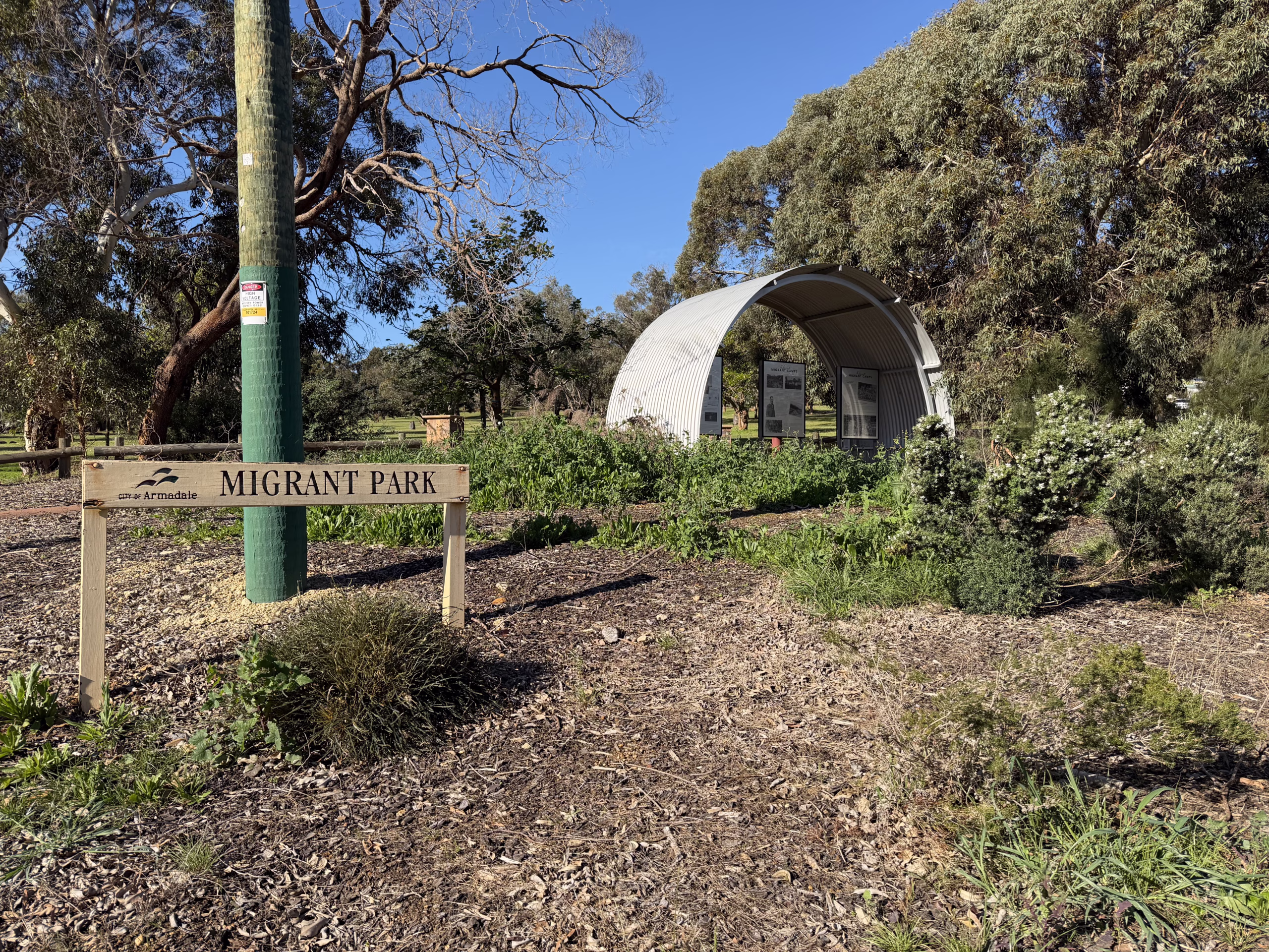
Stand outside our office on Brookton Highway, look across the road and up about 100 metres, and you are looking at Kelmscott Migrant Park. It is easy to walk past without knowing what it is. For a lot of local families, it is where their story in Australia began.
In the late 1940s the Metropolitan Water Supply set up two migrant camps in Kelmscott. Camp No. 1 stood on the reserve that is now the park, on the corner of Brookton Highway and Bernard Street, with 42 Nissen huts, the curved tin structures you can still see echoed in the park’s picnic shelters today. The second camp sat on what is now Roberts Road, in the grounds of Good Shepherd, with around thirty more.
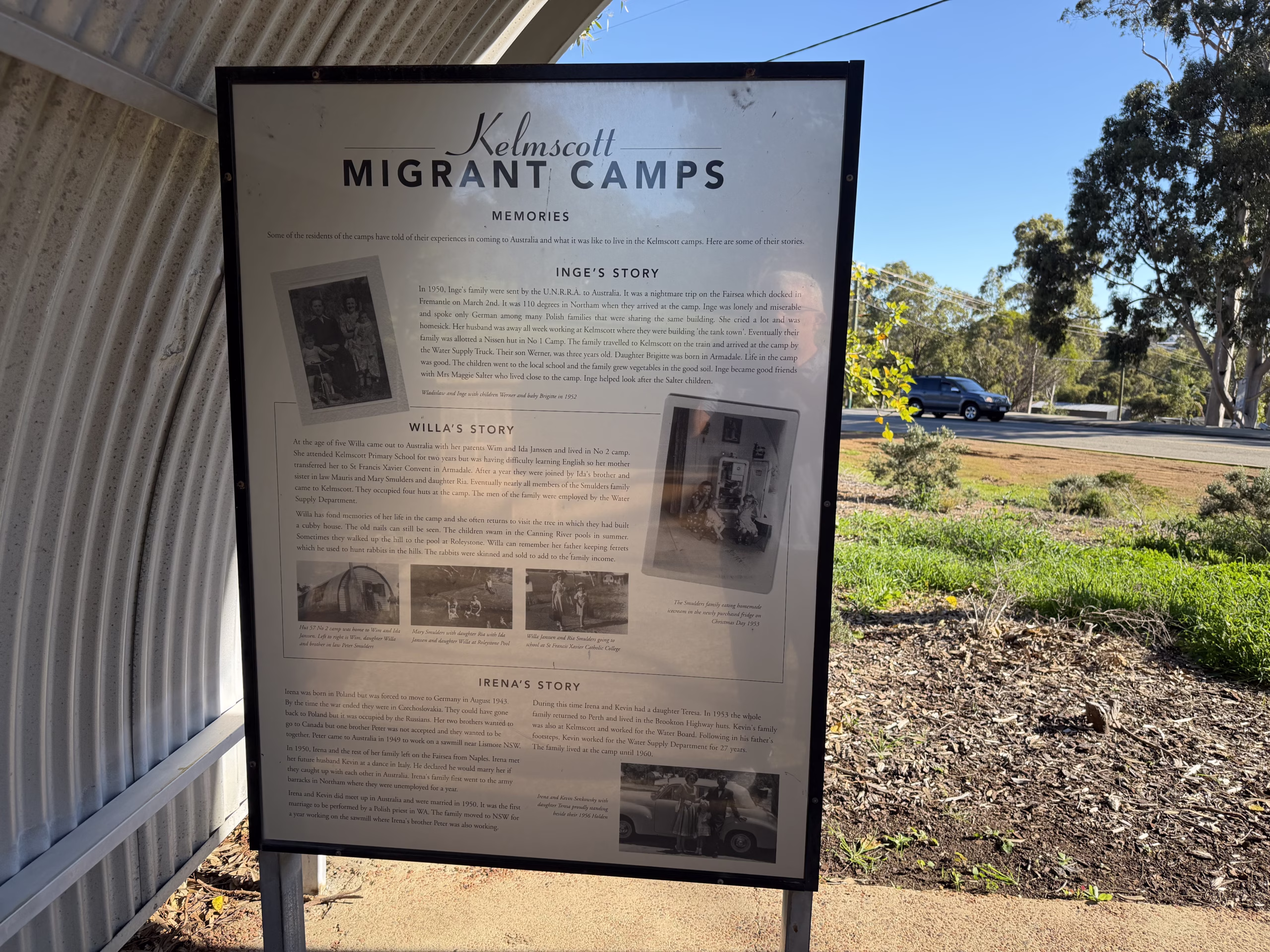
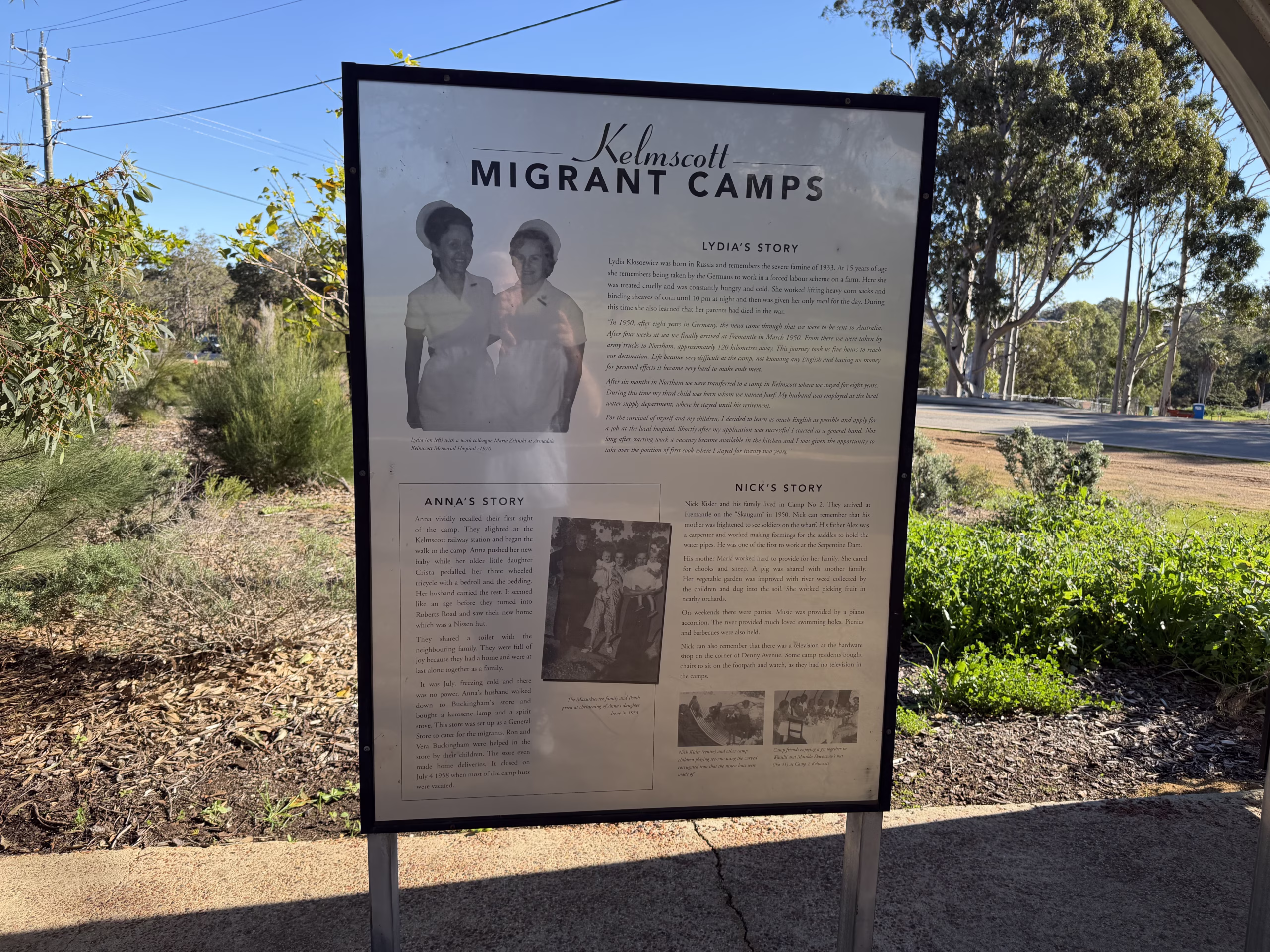
The families who lived there were displaced people from war-torn Europe, resettled after World War II under the United Nations refugee scheme. The men were contracted to work on the pipeline linking Canning Dam to Perth’s reservoirs, and later on the Serpentine Dam. The women cleaned houses and picked fruit in the local orchards. The children walked to Kelmscott School. Over time those families saved, bought blocks, and built homes of their own right here in the district.
That is not ancient history. Plenty of those descendants still live in Kelmscott today, and some of the family names you meet at a home open trace straight back to those camps. It is a big part of why Kelmscott holds onto people the way it does. Families put down roots here and stay for generations.
We think that matters when you are selling. Knowing a suburb is not just knowing its median price. It is knowing who lives here, why they came, and why they stay. We have been part of this community since 2002, and we do not take that lightly.
What locals like about Kelmscott
Established trees and a foothills backdrop, larger blocks than you will find closer to the city, good schools, transport and parks, and genuine affordability compared with the Hills suburbs above it.
Local playgrounds and shaded community spaces make Kelmscott a practical choice for families wanting everyday convenience.
What buyers should understand before buying
Because the suburb is so varied, do your homework on the specific block. Watch for zoning and redevelopment differences, flood-prone and bushfire-interface pockets, older housing stock that can carry asbestos or renovation considerations, and slope, drainage and traffic exposure on some roads. A local agent should be able to tell you which pocket you are standing in and what that means for value.
Large open reserves are part of Kelmscott’s appeal, offering room for sport, recreation and relaxed outdoor living.
Figures move, so treat these as a guide and ask us for a current read on your specific street.
Selling in Kelmscott
Selling well here comes down to three things: identifying the right buyer segment, presenting and pricing to that segment, and positioning the home correctly within its pocket, whether that is foothills lifestyle, redevelopment upside or everyday family convenience. Generic marketing leaves money on the table in a suburb this segmented.
Why work with Naked Real Estate
We are based in Kelmscott and have specialised in the Perth Hills since 2002. Founder Brendan Leahy brings more than 1,500 personal sales and a working knowledge of how each Kelmscott pocket actually trades. Across our verified sales in the 12 months to April 2026, our sale prices averaged 14.64% above the first advertised price. We sell through our Select Date Sale® process, built around strategy and honest advice rather than guesswork.
Selling or buying in Kelmscott? Talk to a local Perth Hills specialist who can tell you which pocket your home sits in and what it is really worth.
Harrisdale is a southeastern suburb of Perth, and is one of the western suburbs of the City of Armadale. It was gazetted in 2007.
The population of the developing area is expected to grow from about 3,500 in 2011 to over 10,000 in 2031. The suburb is bounded by Warton Road to the northwest, Ranford Road to the northeast, Skeet Road to the southeast and Nicholson Road to the southwest. Harrisdale is made up with the Arion, Heron Park, Harrisdale Green and Vertu Estates. With Southern River Shopping Centre nearby and other infrastructure planned for the near future such as the $51 million 12,200sqm Stockland Shopping Centre, means Harrisdale is a highly sought after area.
Harrisdale Facts
Postcode: 6112
Local Government: Armadale
Local Schools: Carey Baptist College
Nearby Schools: Ranford P.S., Piara Waters P.S., Thornlie Christian College
Nearby Shops: Southern River Shopping Centre
Bus Services: Bus to Murdoch Train Station
Established in 1890, Gosnells is a thriving southeastern suburb in Perth that spans 15 square kilometres and is home to more than 19,000 residents. Bound by Canning River to the north and east and Wungong Brook and the Southern River to the south, Gosnells enjoys proximity to these natural wonders while simultaneously benefiting from facilities and attractions synonymous with a bustling urban environment.
Life in Gosnells
There is no shortage of things to do in Gosnells. For those who crave the outdoors and nature there are upwards of 30 parks, reserves and wetlands within the area for you to explore, as well as fitness and athletic facilities like the Harmony Fields Fitness Track, which offers all the benefits of a gym without the costly membership fees. Other major features of the area include the Gosnells Railway Station, Gosnells Railway Markets, Foothills Shopping Centre, Gosnells Shopping Centre, City of Gosnells Museum and numerous schools like Gosnells Primary School and St Munchin’s Catholic School. There are also tennis courts, skate parks, a leisure centre and the Addie Mills Centre, which provides programs and services to seniors and people with disabilities.
Gosnells Facts
Distance to Perth(km): 20
Postcode: 6110
Local Government: Gosnells
Local Schools: Gosnells P.S., Ashburton Drive P.S., St Munchins P.S., Gosnells S.H.S., Seaforth P.S., Wirrabirra P.S
Nearby Schools: Sacred Heart Primary School (Thornlie) , Good Shaperd Catholic Primary School (Kelmscott) , John Wollaston Anglican Community School (Kelmscott)
Nearby Shops: Corfield and Ashburton Village, Thornlie Square
Train Stations: Seaforth or Gosnells
Bus Services: Bus Service to Seaforth or Gosnells train stations
Darling Downs is an outer southeastern suburb of Perth, Western Australia, within the Shire of Serpentine-Jarrahdale. The name, referring to the suburb’s proximity to the Darling Scarp, was first used as an estate name in 1977, and adopted as a suburb name in 1997. If you are looking for nature but not ready to leave the city, Darling Downs could be for you.
Darling Downs Facts
Distance to Perth(km): 31
Postcode: 6122
Local Government: Serpentine-Jarrahdale
Nearby Schools: Xavier Catholic School (Brookdale) , Helena College Junior School (Darlington)
Train Stations: Armadale
Bus Services: Bus Service to Armadale Train Station
Canning Vale is named for its location which is a low lying area near the Canning River, which was named after George Canning, former Prime Minister of Great Britain. Population was minimal until the late 1980s, following industrial development in the 1970s. This industrial development has now grown and banister rd is now a complete industrial and commercial site.
The industrial growth, did not deter the residential growth from thriving. In the early 1990’s the population underwent massive growth and grew to over 9000 in 2006. Even today there are more estates still being built and expanded into the neighboring Southern River areas. In 2011 the population reached 30,000, which was has been largely due to the reasonable affordability mix of each dwelling type- leased, owner occupied and mortgaged.
Life in Canning Vale
Canning Vale is just 14km away from the city centre and has several schools to choose from. Local facilities include Canning Vale Shopping Centre, Market City, The Vale Shopping Centre, Whaleback Golf Club, Canning Vale Country Club, Canning Vale Cricket Club and Perth Tamil Cricket Club. There are also lots of walking trails down by the Canning River and throughout the wetlands of Canning Vale. There are some lovely residential areas that are modern with well-manicured gardens, making this suburb a popular place to live.
Canning Vale Facts
Distance to Perth(km): 17
Postcode: 6155
Local Government: Canning/Gosnells
Local Schools: Caladenia P.S., Canning Vale P.S., Campbell P.S., Canning Vale Catholic P.S., Canning Vale Ed Support Centre, Ranford P.S., Canning Vale College, Carey Baptist College, Excelsior P.S., Saint Emilie’s Catholic Primary School
Nearby Schools: St Jude’s Catholic School (Langford) , Sacred Heart Primary
Nearby Shops: Livingston Market Place Shopping Centre, Waratah Village
Train Stations: Murdoch
Bus Services: Local bus service, Bus to Murdoch Train Station