Named after the river that runs through the area, Southern River is part of the City of Gosnells locality. Spanning 14 square kilometres, Southern River provides a family-friendly lifestyle. Extensive urban development in the early 2000s saw the suburb subdivided and urbanised into the functional area it is today, with care taken to preserve much of the wetlands for public recreation.
Life in Southern River
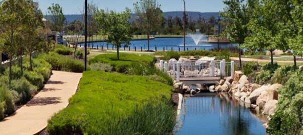
Bound by Southern River Road and Wungong Brook in the north, Tonkin Highway in the east, Ranford Road in the south and Warton Road in the west, Southern River has plenty to offer its residents. One of the highlights of the suburb is Sutherlands Park, a large sporting complex that provides a focus for cricket and football for Southern River, Thornlie and Gosnells. Other notable parks and reserves include Castlewood Parkway and Sanctuary Waters, both of which are built around a lake. Local schools in the area include Bletchley Park Primary School, Southern River College and Thornlie Christian College.
Southern River Facts
Distance to Perth(km): 18
Postcode: 6110
Local Government: Gosnells
Local Schools: Bletchley Park P.S., Southern River P.S., Thornlie Christian College
Nearby Schools: St Munchin’s Catholic School (Gosnells) , Sacred Heart Primary School (Thornlie)
Nearby Shops: Southern River Shopping Centre
Train Stations: Southern River
Bus Services: Bus to Murdoch Train Station
Canning Vale is named for its location which is a low lying area near the Canning River, which was named after George Canning, former Prime Minister of Great Britain. Population was minimal until the late 1980s, following industrial development in the 1970s. This industrial development has now grown and banister rd is now a complete industrial and commercial site.
The industrial growth, did not deter the residential growth from thriving. In the early 1990’s the population underwent massive growth and grew to over 9000 in 2006. Even today there are more estates still being built and expanded into the neighboring Southern River areas. In 2011 the population reached 30,000, which was has been largely due to the reasonable affordability mix of each dwelling type- leased, owner occupied and mortgaged.
Life in Canning Vale
Canning Vale is just 14km away from the city centre and has several schools to choose from. Local facilities include Canning Vale Shopping Centre, Market City, The Vale Shopping Centre, Whaleback Golf Club, Canning Vale Country Club, Canning Vale Cricket Club and Perth Tamil Cricket Club. There are also lots of walking trails down by the Canning River and throughout the wetlands of Canning Vale. There are some lovely residential areas that are modern with well-manicured gardens, making this suburb a popular place to live.
Canning Vale Facts
Distance to Perth(km): 17
Postcode: 6155
Local Government: Canning/Gosnells
Local Schools: Caladenia P.S., Canning Vale P.S., Campbell P.S., Canning Vale Catholic P.S., Canning Vale Ed Support Centre, Ranford P.S., Canning Vale College, Carey Baptist College, Excelsior P.S., Saint Emilie’s Catholic Primary School
Nearby Schools: St Jude’s Catholic School (Langford) , Sacred Heart Primary
Nearby Shops: Livingston Market Place Shopping Centre, Waratah Village
Train Stations: Murdoch
Bus Services: Local bus service, Bus to Murdoch Train Station
Bedfordale lifestyle — hills, water, trees and space, all within easy reach of Kelmscott and Armadale.
Bedfordale is one of the Perth Hills’ most tightly held lifestyle suburbs, attracting buyers who want far more than just a house on a block.
People don’t usually end up in Bedfordale by accident. They move here for space, privacy, views, workshops, horses, established trees, and the feeling of being removed from suburban congestion while still remaining connected to Perth.
Where Bedfordale Sits
Located within the Darling Range, Bedfordale offers a genuine semi-rural lifestyle without feeling isolated. Despite the bushland setting and larger landholdings, the suburb remains surprisingly accessible — approximately 25 minutes from Perth Airport, around 40 minutes from the Perth CBD by car, and a short drive to Kelmscott Train Station, with services to Perth Underground in approximately 35 minutes.
For many buyers, Bedfordale offers one of the best balances in the Hills: enough land and privacy to feel like a true lifestyle property, without being hours away from major services and infrastructure.
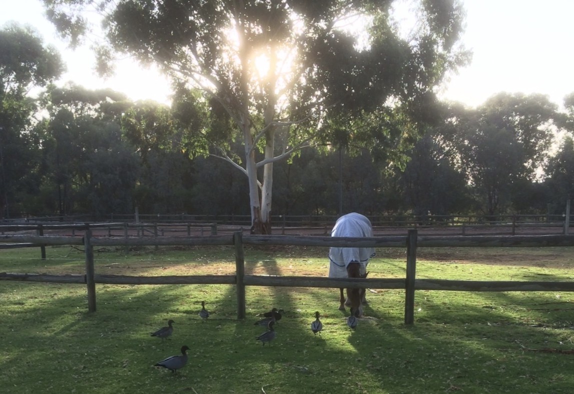
Foggy morning across paddocks with post-and-rail fence
Understanding Bedfordale’s Different Precincts
One of the things many buyers don’t initially realise is that Bedfordale is made up of several very different pockets, each attracting different buyer types and offering a different style of living.
The Original Wallangarra Special Rural Precinct
The original Wallangarra precinct is the more established side of Bedfordale and has been developed for around 40 years. This area is zoned Special Rural, which allows owners to keep horses and other animals — making it particularly popular with equestrian and lifestyle buyers.
Most properties throughout this pocket range between approximately 3 and 6 acres, with many backing directly onto bridle trails — a major drawcard for horse owners wanting direct riding access without needing to float horses elsewhere.
Homes throughout this area are generally reliant on rainwater tanks and bore water rather than scheme water, which is typical for larger lifestyle properties throughout the Perth Hills.
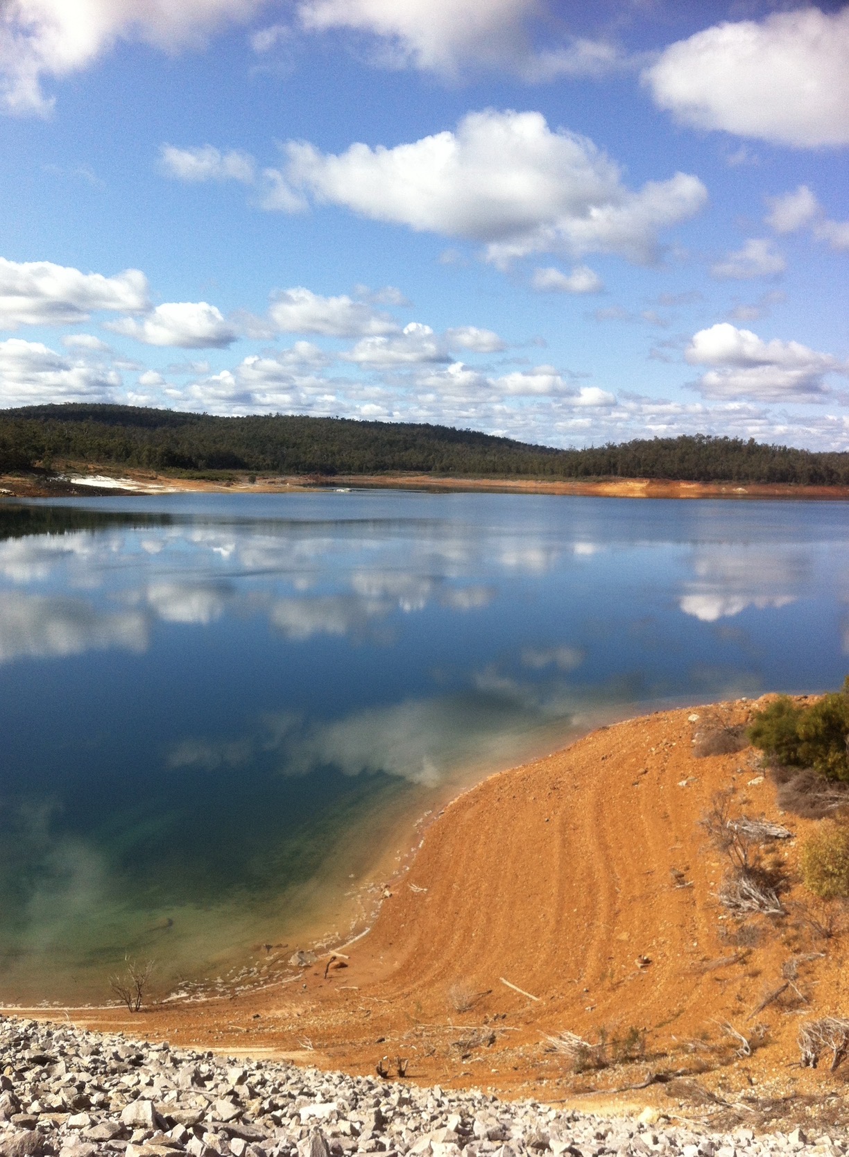
This precinct is also highly regarded for its proximity to Churchman Brook Dam, walking trails, native bushland and Southern Hills Christian College.
Churchman Brook Dam
The Cairns Road & Carradine Road Precinct
The Cairns Road and Carradine Road pocket is known for larger acreage holdings, with many properties sitting on approximately 10-acre parcels.
Over the past decade, many homes throughout this area have been extensively renovated or rebuilt to a very high standard, creating some of Bedfordale’s most impressive lifestyle properties.
One of the major attractions is the elevated positioning and outstanding valley views, with some homes enjoying outlooks towards the Perth city skyline and even glimpses of the coastline on clear days.
Most properties throughout this precinct rely on bore water and rainwater tanks, although there are some exceptions with scheme water connected to select homes.
This pocket tends to attract buyers wanting privacy, quality homes and larger landholdings while still remaining relatively close to schools, shops and transport connections.
Bedfordale’s Lifestyle Estates
Bedfordale also features several newer lifestyle estates which appeal to buyers wanting a Hills lifestyle without the maintenance requirements of larger acreage properties.
These homes are generally positioned on blocks ranging from approximately 3,000 sqm to 4,000 sqm and are connected to scheme water.
Unlike some of the older Bedfordale homes, properties within these estates are relatively modern, with most homes built within the last 10 to 25 years.
Popular estates include:
Churchman Brook Estate
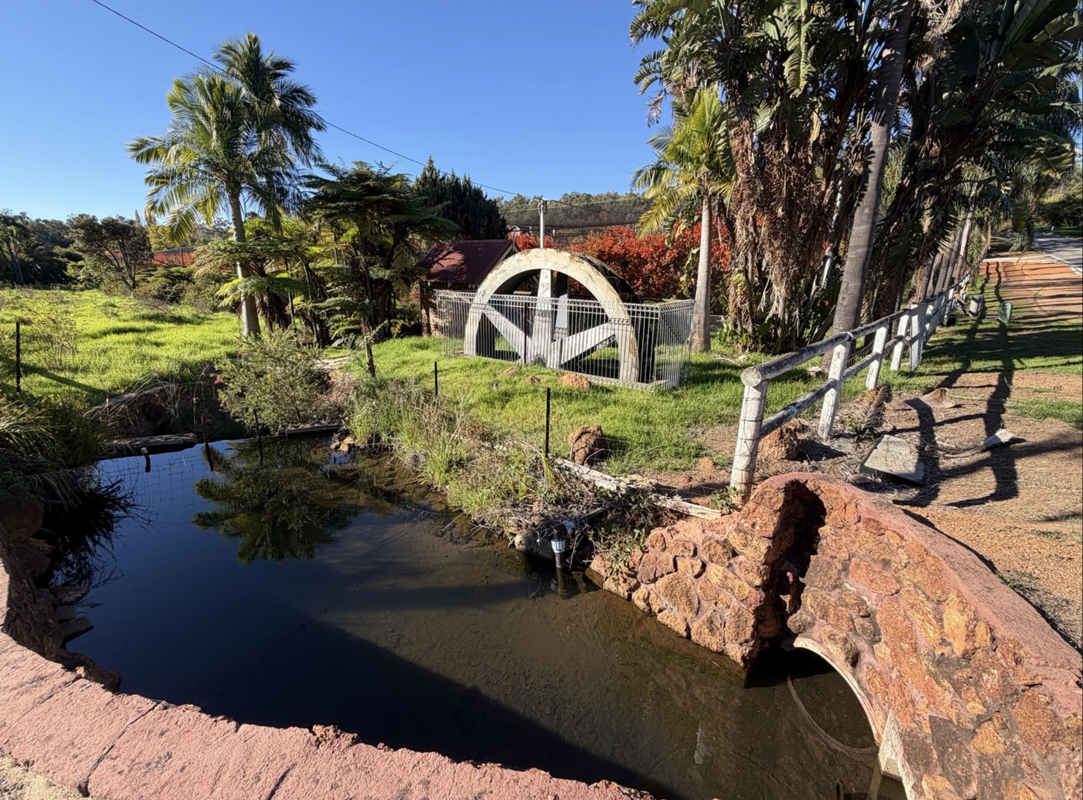
Waterwheel Ridge
Camfield Estate
Bedfordale Heights
These areas are especially popular with upsizing families coming from surrounding suburban areas who still want space, privacy and larger blocks, but without managing horses, paddocks or extensive acreage.
Who Buys in Bedfordale
Bedfordale attracts a very different buyer profile compared to standard suburban markets. The strongest buyer groups are usually:
Upsizing families. Families moving out of suburbs such as Kelmscott, Byford, Mount Nasura or Armadale who want more land, greater privacy and room for children to grow up outdoors.
Lifestyle and acreage buyers. Buyers wanting workshops, side access, pools, gardens, fruit trees, sheds, caravans, trailers — or simply separation from neighbours.
Horse and equestrian buyers. Particularly throughout the Wallangarra precinct, Bedfordale remains highly sought after by buyers wanting horse-friendly properties with direct access to bridle trails.
Professionals escaping suburban density. Many buyers still work in Perth or surrounding commercial centres but no longer want the congestion, traffic and smaller blocks associated with suburban living.
Established buyers. With Bedfordale’s recent median sale price sitting at approximately $1,460,000, the suburb is now primarily attracting second and third-home buyers rather than entry-level purchasers.
What Locals Love About Bedfordale
The biggest thing buyers notice in Bedfordale is the feeling of space.
Not just larger blocks, but genuine separation between homes, established trees, quieter streets and a more relaxed pace of living.
Many homes feature long driveways, wide frontages, workshops and sheds, valley views, established gardens, pools and outdoor entertaining areas, usable land for animals or hobbies, and real privacy from neighbouring properties.
Unlike newer suburban estates, Bedfordale properties often feel individual and unique rather than repetitive.
The suburb is also popular with buyers who enjoy hiking and walking trails, horse riding, mountain biking, native wildlife and bushland scenery — and a quieter Hills lifestyle generally.
Community & Lifestyle
One of Bedfordale’s biggest strengths — and something many buyers only fully appreciate after moving in — is the strong sense of community.
Despite being only a relatively short drive from Perth Airport and the CBD, Bedfordale still retains a genuine Hills community feel that has become much harder to find in newer suburban developments.
The Bedfordale Volunteer Bushfire Brigade is heavily supported by locals, with the newer station becoming an important part of the community in recent years. In a Hills suburb like Bedfordale, buyers tend to appreciate that community involvement and preparedness are taken seriously.
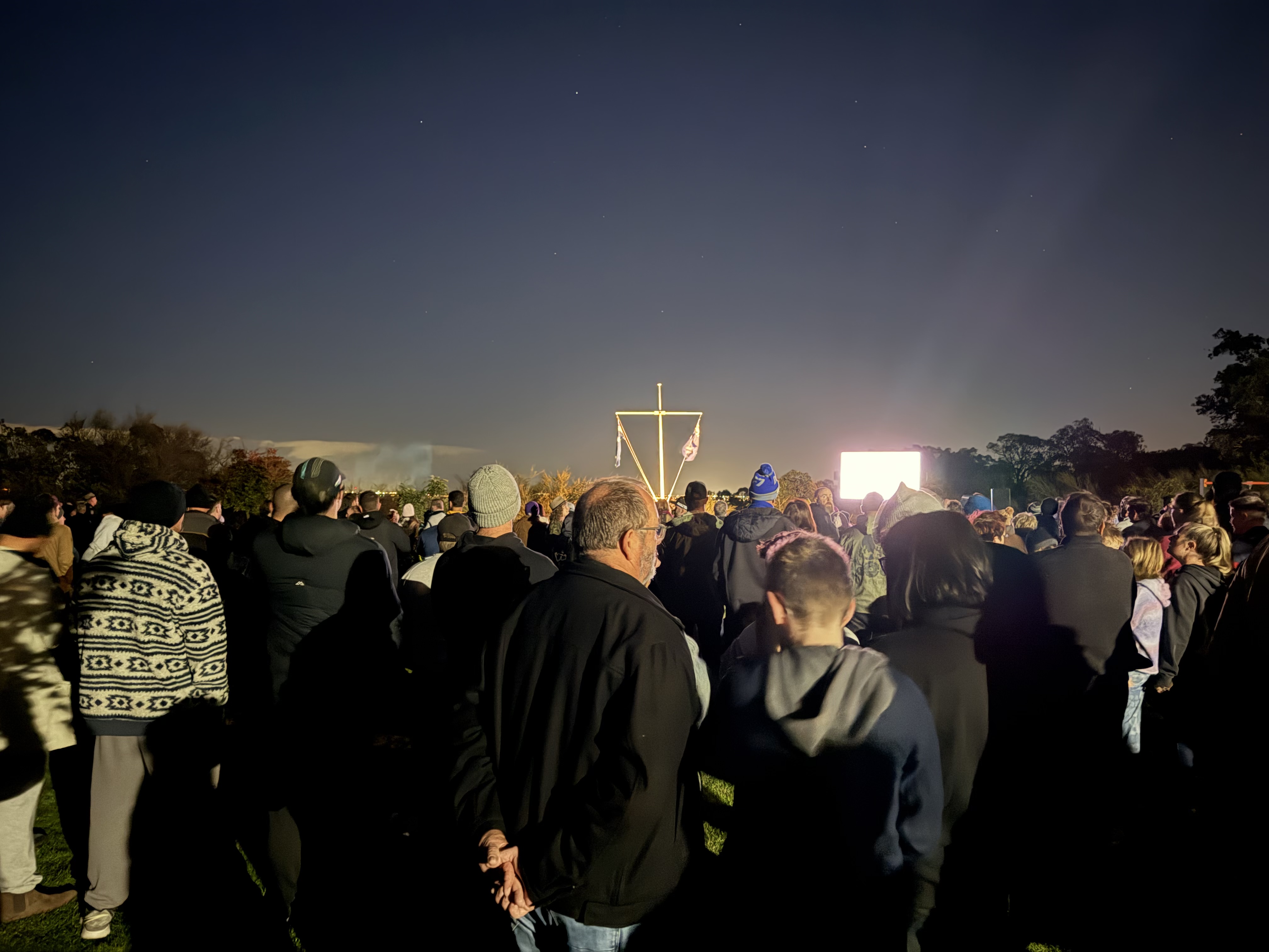
The local Country Women’s Association also plays a significant role, particularly around ANZAC Day commemorations and other local events throughout the year.
Bedfordale ANZAC Day dawn service
There are also a number of smaller community groups and clubs throughout the suburb, including local book clubs and the Men’s Shed on Waterwheel Road — all contributing to the connected and community-focused feel Bedfordale is known for.
For many residents, that balance between privacy and community is one of the suburb’s biggest drawcards. You can enjoy space and seclusion on your own property while still feeling connected to the local area.
Limited Supply & Long-Term Scarcity
One of the major reasons Bedfordale continues to see strong long-term demand is the simple fact that there is very limited opportunity for large-scale future development.
With only approximately 1,025 homes throughout the suburb, Bedfordale remains relatively small compared to many surrounding residential areas.
A significant portion of the surrounding land is made up of national park, bushland and Water Corporation catchment land, which naturally restricts future expansion and helps preserve the semi-rural character the suburb is known for.
For buyers, this is a major part of Bedfordale’s appeal. Unlike many outer suburban areas where large estates continue to expand year after year, Bedfordale’s overall size and character are far more protected.
That limited housing supply, combined with strong lifestyle appeal, is one of the key reasons quality Bedfordale properties continue to attract strong buyer competition.
Schools & Amenities
Southern Hills Christian College is one of the major drawcards for many Bedfordale families, offering Kindergarten through to Year 12 education within the suburb itself.
While Bedfordale maintains its semi-rural feel, residents still benefit from close access to:
Kelmscott shopping precinct
Armadale Central
cafés and restaurants
train stations
medical facilities
sporting clubs
major road connections
That balance between lifestyle and convenience is one of the reasons Bedfordale continues to attract strong long-term demand.
Important Things Buyers Should Understand
Bedfordale is not a standard suburban market, and buyers need to understand the practical side of owning a Hills lifestyle property.
Depending on the property, buyers may need to consider:
bushfire preparedness
BAL (Bushfire Attack Level) ratings
septic systems
rainwater tanks and bore water
driveway access
slope and drainage
fencing and paddock usability
tree management
insurance considerations
internet and mobile coverage in some pockets
For serious lifestyle buyers, these are generally viewed as part of the appeal rather than drawbacks. However, local knowledge becomes extremely important here, because conditions can vary significantly from one property to the next.
Bedfordale Market Snapshot
The Bedfordale market remains extremely tightly held.
Recent figures show:
approximately 15 homes sold in the previous six months
around 5 homes available for sale
average days on market sitting at 11 days
median sale price reaching approximately $1,460,000
median values increasing 24.6% over 12 months
Recent sales have included everything from 3,000 sqm lifestyle properties through to larger acreage holdings exceeding 40,000 sqm, highlighting the suburb’s broad appeal across multiple buyer types.
Well-presented properties in desirable pockets continue to attract very strong buyer competition.
Selling a Bedfordale property is very different to selling a standard suburban home.
Buyers are not simply comparing bedrooms and bathrooms. They are comparing:
land usability
privacy
views
water setup
horse facilities
workshops
driveway access
tree coverage
entertaining spaces
property positioning
overall lifestyle appeal
That means proper marketing matters. A generic listing saying “large block” is not enough in Bedfordale. Buyers want detailed information and local insight, because no two properties are truly the same.
Why Work With Naked Real Estate
Experience matters in any market. The wrong choice of agent can cost you thousands — so why risk your biggest asset?
Brendan Leahy has been selling property throughout the Perth Hills since 2002. He founded his own agency in 2006 and rebranded to Naked Real Estate in 2012, with a continued focus on Bedfordale, Kelmscott, Roleystone, Mount Nasura, Mount Richon and Seville Grove.
With over 1,503 personal home sales and more than $760 million in total sales value across his career — and named 2023 Agency of the Year for Bedfordale, Kelmscott and Mount Nasura — Brendan brings genuine local experience to a market where property differences can vary enormously from one street to the next.
In Bedfordale, local knowledge matters. Understanding the different precincts, buyer types, land usability and lifestyle appeal can make a significant difference when it comes to both pricing and marketing strategy.